Area Overview for PO14 1JT
Photos of PO14 1JT
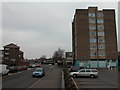
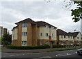
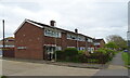
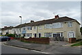
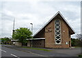
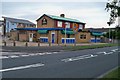
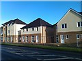
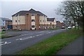
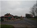
18 photos from this area
Area Information
Key information about the PO14 1JT including its size, population, and administrative classification.
- Area Type
- Postcode
- Area Size
- 5357 m²
- Population
- 1571
- Population Density
- 5478 people/km²
House Prices in PO14 1JT
14
Properties
£163,550
Average Sold Price
£59,000
Lowest Price
£260,000
Highest Price
Showing 14 properties
| Address | Type | Beds | Baths | Last Sale Price | Last Sale Date | |
|---|---|---|---|---|---|---|
| 106 Longfield Avenue, Fareham, PO14 1JT | house | - | - | £258,000 | Aug 2024 | |
| 108 Longfield Avenue, Fareham, PO14 1JT | Terraced | 3 | 1 | £260,000 | Jan 2024 | |
| 100 Longfield Avenue, Fareham, PO14 1JT | Terraced | 3 | 1 | £235,000 | Jun 2021 | |
| 112 Longfield Avenue, Fareham, PO14 1JT | Flat | 2 | 1 | £113,000 | Jan 2021 | |
| 96 Longfield Avenue, Fareham, PO14 1JT | Terraced | 3 | 1 | £225,000 | Jan 2020 | |
| 118 Longfield Avenue, Fareham, PO14 1JT | Semi-detached | - | - | £161,000 | Jul 2005 | |
| 116 Longfield Avenue, Fareham, PO14 1JT | house | - | - | £94,000 | Dec 2001 | |
| 104 Longfield Avenue, Fareham, PO14 1JT | Terraced | 3 | 2 | £66,950 | Feb 2000 | |
| 110 Longfield Avenue, Fareham, PO14 1JT | Terraced | - | - | £59,000 | May 1999 | |
| 114 Longfield Avenue, Fareham, PO14 1JT | Flat | 2 | 1 | - | - |
Page 1 of 2
Energy Efficiency in PO14 1JT
Amenities
Schools
| Rank | School | Type | Entry gender | Ages |
|---|
Explore more schools in this area
Go to Schools tabDemographics
Household Size
Two person
most common
Accommodation Type
Houses
most common
Tenure
73
majority
Ethnic Group
White
most common
Religion
N/A
most common
Household Composition
N/A
most common
Age
47
median
Adults (30-64 years)
most common
Household Deprivation
N/A
with no deprivation
NS-SEC
29
in Lower managerial occupations
Explore more demographic insights in this area
Go to Demographics tabPlanning
Planning Constraints
- Flood RiskPremium
- Ramsar Wetland SitesPremium
- Area of Outstanding Natural BeautyPremium
- Protected Nature ReservePremium
- Protected WoodlandPremium