Area Overview for PO13 9UY
Photos of PO13 9UY

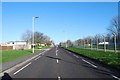
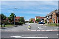
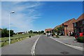
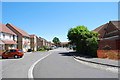
100 photos from this area
Area Information
Key information about the PO13 9UY including its size, population, and administrative classification.
- Area Type
- Postcode
- Area Size
- 1.3 hectares
- Population
- 2190
- Population Density
- 8697 people/km²
House Prices in PO13 9UY
39
Properties
£147,513
Average Sold Price
£48,500
Lowest Price
£290,000
Highest Price
Showing 39 properties
| Address | Type | Beds | Baths | Last Sale Price | Last Sale Date | |
|---|---|---|---|---|---|---|
| 4 Lanyard Drive, Gosport, PO13 9UY | Terraced | 2 | 1 | £220,000 | Oct 2025 | |
| 6 Lanyard Drive, Gosport, PO13 9UY | Terraced | 3 | 2 | £235,000 | Jan 2025 | |
| 15 Lanyard Drive, Gosport, PO13 9UY | Terraced | 2 | 1 | £222,500 | Nov 2024 | |
| 46 Lanyard Drive, Gosport, PO13 9UY | Terraced | 3 | 2 | £260,000 | Oct 2024 | |
| 25 Lanyard Drive, Gosport, PO13 9UY | Terraced | 3 | 1 | £250,000 | Jul 2024 | |
| 9 Lanyard Drive, Gosport, PO13 9UY | Terraced | 3 | 2 | £290,000 | Aug 2023 | |
| 10 Lanyard Drive, Gosport, PO13 9UY | Terraced | 2 | 1 | £208,000 | Jul 2022 | |
| 17 Lanyard Drive, Gosport, PO13 9UY | Terraced | 2 | 1 | £210,000 | Sep 2021 | |
| 33 Lanyard Drive, Gosport, PO13 9UY | house | - | - | £230,000 | Dec 2020 | |
| 28 Lanyard Drive, Gosport, PO13 9UY | Detached | 2 | 1 | £162,000 | Dec 2019 |
Page 1 of 4
Energy Efficiency in PO13 9UY
Amenities
Schools
| Rank | School | Type | Entry gender | Ages |
|---|
Explore more schools in this area
Go to Schools tabDemographics
Household Size
Family (3-5 people)
most common
Accommodation Type
Houses
most common
Tenure
49
majority
Ethnic Group
White
most common
Religion
N/A
most common
Household Composition
N/A
most common
Age
22
median
Adults (30-64 years)
most common
Household Deprivation
N/A
with no deprivation
NS-SEC
28
in Lower managerial occupations
Explore more demographic insights in this area
Go to Demographics tabPlanning
Planning Constraints
- Flood RiskPremium
- Ramsar Wetland SitesPremium
- Area of Outstanding Natural BeautyPremium
- Protected Nature ReservePremium
- Protected WoodlandPremium