Area Overview for PO13 9JQ
Photos of PO13 9JQ
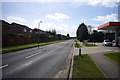

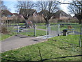
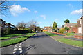
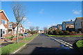
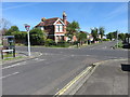
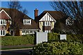

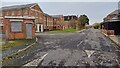

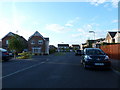
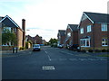
100 photos from this area
Area Information
Key information about the PO13 9JQ including its size, population, and administrative classification.
- Area Type
- Postcode
- Area Size
- 3.2 hectares
- Population
- 2590
- Population Density
- 2773 people/km²
House Prices in PO13 9JQ
32
Properties
£533,203
Average Sold Price
£89,000
Lowest Price
£825,500
Highest Price
Showing 32 properties
| Address | Type | Beds | Baths | Last Sale Price | Last Sale Date | |
|---|---|---|---|---|---|---|
| 44 Manor Way, Lee On The Solent, PO13 9JQ | house | - | - | £595,000 | Mar 2025 | |
| 73 Manor Way, Lee On The Solent, PO13 9JQ | house | 4 | 3 | £730,000 | Mar 2025 | |
| 59 Manor Way, Lee On The Solent, PO13 9JQ | Detached | 4 | 3 | £825,500 | Dec 2022 | |
| 89 Manor Way, Lee On The Solent, PO13 9JQ | Semi-detached | 4 | - | £700,000 | Jan 2021 | |
| 21 Manor Way, Lee On The Solent, PO13 9JQ | Detached | 4 | 3 | £585,000 | Jul 2020 | |
| 17 Manor Way, Lee On The Solent, PO13 9JQ | Bungalow | 3 | - | £475,000 | Dec 2019 | |
| 91 Manor Way, Lee On The Solent, PO13 9JQ | Bungalow | 2 | 2 | £545,000 | Mar 2018 | |
| 71 Manor Way, Lee On The Solent, PO13 9JQ | house | 5 | 1 | £696,500 | Oct 2017 | |
| 57 Manor Way, Lee On The Solent, PO13 9JQ | Detached | 3 | 1 | £440,500 | Aug 2014 | |
| 31 Manor Way, Lee On The Solent, PO13 9JQ | Bungalow | 2 | - | £335,000 | Aug 2014 |
Page 1 of 4
Energy Efficiency in PO13 9JQ
Amenities
Schools
| Rank | School | Type | Entry gender | Ages |
|---|
Explore more schools in this area
Go to Schools tabDemographics
Household Size
Two person
most common
Accommodation Type
Houses
most common
Tenure
72
majority
Ethnic Group
White
most common
Religion
N/A
most common
Household Composition
N/A
most common
Age
47
median
Adults (30-64 years)
most common
Household Deprivation
N/A
with no deprivation
NS-SEC
48
in Lower managerial occupations
Explore more demographic insights in this area
Go to Demographics tabPlanning
Planning Constraints
- Flood RiskPremium
- Ramsar Wetland SitesPremium
- Area of Outstanding Natural BeautyPremium
- Protected Nature ReservePremium
- Protected WoodlandPremium