Area Overview for PO13 8GN
Photos of PO13 8GN


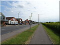
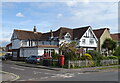
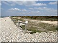
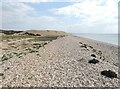
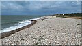
100 photos from this area
Area Information
Key information about the PO13 8GN including its size, population, and administrative classification.
- Area Type
- Postcode
- Area Size
- 2.8 hectares
- Population
- 1703
- Population Density
- 1478 people/km²
House Prices in PO13 8GN
53
Properties
£370,835
Average Sold Price
£152,500
Lowest Price
£630,000
Highest Price
Showing 53 properties
| Address | Type | Beds | Baths | Last Sale Price | Last Sale Date | |
|---|---|---|---|---|---|---|
| 18 Proctor Drive, Lee On The Solent, PO13 8GN | house | 5 | 2 | £630,000 | Mar 2025 | |
| 20 Proctor Drive, Lee On The Solent, PO13 8GN | Detached | 5 | 3 | £630,000 | Mar 2025 | |
| 21 Proctor Drive, Lee On The Solent, PO13 8GN | house | 4 | 2 | £375,000 | May 2024 | |
| 39 Proctor Drive, Lee On The Solent, PO13 8GN | house | - | - | £585,000 | Dec 2022 | |
| 14 Proctor Drive, Lee On The Solent, PO13 8GN | house | - | - | £480,000 | Nov 2022 | |
| 37 Proctor Drive, Lee On The Solent, PO13 8GN | house | - | - | £575,000 | Mar 2022 | |
| 22 Proctor Drive, Lee On The Solent, PO13 8GN | house | - | - | £518,450 | May 2021 | |
| 24 Proctor Drive, Lee On The Solent, PO13 8GN | Detached | 5 | 3 | £530,000 | May 2021 | |
| 51 Proctor Drive, Lee On The Solent, PO13 8GN | Semi-detached | 4 | 2 | £320,000 | Mar 2021 | |
| 3 Proctor Drive, Lee On The Solent, PO13 8GN | house | - | - | £439,000 | Dec 2020 |
Page 1 of 6
Energy Efficiency in PO13 8GN
Amenities
Schools
| Rank | School | Type | Entry gender | Ages |
|---|
Explore more schools in this area
Go to Schools tabDemographics
Household Size
Family (3-5 people)
most common
Accommodation Type
Houses
most common
Tenure
76
majority
Ethnic Group
White
most common
Religion
N/A
most common
Household Composition
N/A
most common
Age
47
median
Adults (30-64 years)
most common
Household Deprivation
N/A
with no deprivation
NS-SEC
41
in Lower managerial occupations
Explore more demographic insights in this area
Go to Demographics tabPlanning
Planning Constraints
- Flood RiskPremium
- Ramsar Wetland SitesPremium
- Area of Outstanding Natural BeautyPremium
- Protected Nature ReservePremium
- Protected WoodlandPremium