Area Overview for PO13 8EL
Photos of PO13 8EL

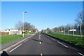
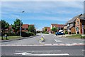
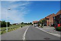
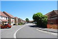
100 photos from this area
Area Information
Key information about the PO13 8EL including its size, population, and administrative classification.
- Area Type
- Postcode
- Area Size
- 2.2 hectares
- Population
- 2190
- Population Density
- 8697 people/km²
House Prices in PO13 8EL
43
Properties
£97,512
Average Sold Price
£27,995
Lowest Price
£146,000
Highest Price
Showing 43 properties
| Address | Type | Beds | Baths | Last Sale Price | Last Sale Date | |
|---|---|---|---|---|---|---|
| 32, Mandarin Way, Howe Road, Gosport, PO13 8EL | Flat | - | - | £74,500 | Oct 2025 | |
| 40, Mandarin Way, Howe Road, Gosport, PO13 8EL | Flat | - | - | £132,500 | Mar 2025 | |
| 6, Mandarin Way, Howe Road, Gosport, PO13 8EL | Flat | - | - | £135,000 | Oct 2024 | |
| 33, Mandarin Way, Howe Road, Gosport, PO13 8EL | Flat | 2 | - | £140,000 | Apr 2024 | |
| 31, Mandarin Way, Howe Road, Gosport, PO13 8EL | Flat | - | - | £140,000 | Aug 2023 | |
| 25, Mandarin Way, Howe Road, Gosport, PO13 8EL | Flat | - | - | £146,000 | Feb 2023 | |
| 17, Mandarin Way, Howe Road, Gosport, PO13 8EL | Flat | - | - | £140,000 | Dec 2022 | |
| 20, Mandarin Way, Howe Road, Gosport, PO13 8EL | Flat | 3 | 1 | £143,000 | Jul 2022 | |
| 3, Mandarin Way, Howe Road, Gosport, PO13 8EL | Flat | - | - | £133,000 | Apr 2022 | |
| 18, Mandarin Way, Howe Road, Gosport, PO13 8EL | Flat | - | - | £130,000 | Mar 2022 |
Page 1 of 5
Energy Efficiency in PO13 8EL
Amenities
Schools
| Rank | School | Type | Entry gender | Ages |
|---|
Explore more schools in this area
Go to Schools tabDemographics
Household Size
Family (3-5 people)
most common
Accommodation Type
Houses
most common
Tenure
49
majority
Ethnic Group
White
most common
Religion
N/A
most common
Household Composition
N/A
most common
Age
22
median
Adults (30-64 years)
most common
Household Deprivation
N/A
with no deprivation
NS-SEC
28
in Lower managerial occupations
Explore more demographic insights in this area
Go to Demographics tabPlanning
Planning Constraints
- Flood RiskPremium
- Ramsar Wetland SitesPremium
- Area of Outstanding Natural BeautyPremium
- Protected Nature ReservePremium
- Protected WoodlandPremium