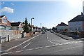
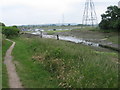
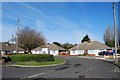
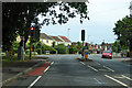
Area Overview for PO13 0WB
Photos of PO13 0WB


Area Information
PO13 0WB is a specific postcode area covering a small residential cluster. It is distinct for its streamlined administration as a defined postcode rather than a broad village. Living in PO13 0WB means residing within a compact zone where local services are concentrated. The immediate environment presents significant advantages regarding environmental safety and planning constraints. There is no recorded flood risk coverage for this location. Furthermore, the area contains no Ramsar wetland sites or Areas of Outstanding Natural Beauty. These factors indicate standard development rules apply during construction of homes in PO13 0WB. Residents do not face restrictions related to protected nature reserves. The landscape is unfettered by protected woodland designations. This combination of checks suggests a straightforward living environment. You will find the area is characterized by these clear classifications. A homebuyer seeks certainty regarding their surroundings. PO13 0WB provides a defined boundary for such certainty. The postcode serves as the primary identifier for daily navigation. You can access the local streets without worrying about rare environmental designations. The cluster is fully mapped. PO13 0WB stands apart from wider regions through these specific administrative details. Understanding these parameters is key to appreciating the area.
- Area Type
- Postcode
- Area Size
- Not available
- Population
- 1506
- Population Density
- 1521 people/km²
The property market in PO13 0WB is shaped by its classification as a specific postcode area. The housing stock consists of the cluster defined in the records. This area contains a series of residential properties bound by the postcode. Buyers looking at homes in PO13 0WB should note the planning constraints. There are no protected woodland sites or Areas of Outstanding Natural Beauty within the limits. This means development follows standard zoning laws without extra heritage layers. The market focuses on the immediate cluster of dwellings. No Ramsar wetland sites exist to halt construction in this zone. The absence of these protections simplifies the viewing process for potential buyers. However, the crime risk assessment acts as a market dampener. A warning level suggests buyers must weigh security costs against location benefits. This postcode is not a luxury zone. It is a practical choice for those seeking defined boundaries. You will find the market here is driven by these safety ratings. The price point will reflect the medium crime risk. Buyers should consider the security scores. Living in PO13 0WB is a decision based on these hard figures. The market moves according to standard postcode logic. It is a residential reality without hidden planning surprises.
House Prices in PO13 0WB
No properties found in this postcode.
Energy Efficiency in PO13 0WB
Amenities
Schools
| Rank | School | Type | Entry gender | Ages |
|---|
Explore more schools in this area
Go to Schools tabDemographics
The community in PO13 0WB is centred on its function as a small residential cluster. This specific designation implies a high density of housing within a defined boundary. You can expect a neighbourhood where neighbours are close by. The population makeup follows standard town patterns, though exact age profiles are not listed. The primary fact is the concentration of dwellings. This density influences the pace of daily life. Homes in PO13 0WB are situated in this cluster. You may find a mix of families and individuals within these walls. The area supports standard household types typical of such clusters. Deprivation data is not explicitly detailed in the provided records for this location. Instead, the primary metric for community welfare here is the safety score. This score reflects the lived experience of residents better than generic averages. The crime risk rating offers a concrete view of household stability. Living in PO13 0WB involves navigating a space where safety is the dominant community metric. The environment is shaped by the need for standard security precautions. The people who choose this postcode value the known constraints. Understanding the risk profile clarifies the demographic expectations. You are buying into this verified safety profile. The cluster is populated by those who accept these conditions.
Household Size
Accommodation Type
Tenure
Ethnic Group
Religion
Household Composition
Age
Household Deprivation
NS-SEC
Explore more demographic insights in this area
Go to Demographics tabPlanning
Planning Constraints
- Flood RiskPremium
- Ramsar Wetland SitesPremium
- Area of Outstanding Natural BeautyPremium
- Protected Nature ReservePremium
- Protected WoodlandPremium