Area Overview for PO13 0SU
Photos of PO13 0SU

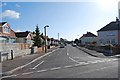

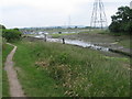
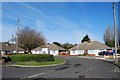

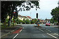

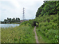


35 photos from this area
Area Information
Key information about the PO13 0SU including its size, population, and administrative classification.
- Area Type
- Postcode
- Area Size
- 4721 m²
- Population
- 1506
- Population Density
- 1521 people/km²
House Prices in PO13 0SU
12
Properties
£126,071
Average Sold Price
£39,000
Lowest Price
£200,000
Highest Price
Showing 12 properties
| Address | Type | Beds | Baths | Last Sale Price | Last Sale Date | |
|---|---|---|---|---|---|---|
| 7A Wych Lane, Gosport, PO13 0SU | Flat | - | - | £200,000 | Mar 2022 | |
| 15 Wych Lane, Gosport, PO13 0SU | Terraced | 2 | 1 | £169,000 | Jan 2019 | |
| 9 Wych Lane, Gosport, PO13 0SU | house | 3 | - | £124,000 | Feb 2013 | |
| 1 Wych Lane, Gosport, PO13 0SU | Terraced | - | - | £172,000 | May 2006 | |
| 13 Wych Lane, Gosport, PO13 0SU | Terraced | - | - | £119,500 | Sep 2004 | |
| 3 Wych Lane, Gosport, PO13 0SU | Terraced | - | - | £59,000 | Aug 1999 | |
| 19 Wych Lane, Gosport, PO13 0SU | Terraced | - | - | £39,000 | Sep 1996 | |
| 17 Wych Lane, Gosport, PO13 0SU | Terraced | - | - | - | - | |
| 7 Wych Lane, Gosport, PO13 0SU | Flat | - | - | - | - | |
| 11 Wych Lane, Gosport, PO13 0SU | Terraced | 3 | 1 | - | - |
Page 1 of 2
Energy Efficiency in PO13 0SU
Amenities
Schools
| Rank | School | Type | Entry gender | Ages |
|---|
Explore more schools in this area
Go to Schools tabDemographics
Household Size
Two person
most common
Accommodation Type
Houses
most common
Tenure
82
majority
Ethnic Group
White
most common
Religion
N/A
most common
Household Composition
N/A
most common
Age
47
median
Adults (30-64 years)
most common
Household Deprivation
N/A
with no deprivation
NS-SEC
31
in Lower managerial occupations
Explore more demographic insights in this area
Go to Demographics tabPlanning
Planning Constraints
- Flood RiskPremium
- Ramsar Wetland SitesPremium
- Area of Outstanding Natural BeautyPremium
- Protected Nature ReservePremium
- Protected WoodlandPremium