Area Overview for PO12 4QR
Photos of PO12 4QR

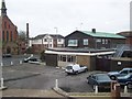
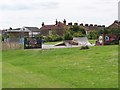
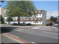
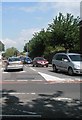
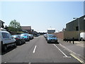
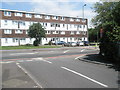
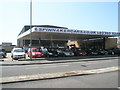
100 photos from this area
Area Information
Key information about the PO12 4QR including its size, population, and administrative classification.
- Area Type
- Postcode
- Area Size
- 5350 m²
- Population
- 1454
- Population Density
- 9065 people/km²
House Prices in PO12 4QR
25
Properties
£145,500
Average Sold Price
£31,000
Lowest Price
£257,000
Highest Price
Showing 25 properties
| Address | Type | Beds | Baths | Last Sale Price | Last Sale Date | |
|---|---|---|---|---|---|---|
| 60 San Diego Road, Gosport, PO12 4QR | Terraced | 3 | 1 | £257,000 | Jul 2024 | |
| 30 San Diego Road, Gosport, PO12 4QR | house | 3 | - | £190,000 | Dec 2021 | |
| 22 San Diego Road, Gosport, PO12 4QR | house | - | - | £169,000 | Mar 2021 | |
| 56 San Diego Road, Gosport, PO12 4QR | Terraced | 2 | 1 | £180,000 | Jan 2021 | |
| 14 San Diego Road, Gosport, PO12 4QR | Terraced | 3 | 1 | £125,000 | Apr 2019 | |
| 50 San Diego Road, Gosport, PO12 4QR | Terraced | 2 | 1 | £173,000 | Jan 2019 | |
| 42 San Diego Road, Gosport, PO12 4QR | house | - | - | £168,000 | Oct 2016 | |
| 54 San Diego Road, Gosport, PO12 4QR | Terraced | 2 | - | £154,000 | Feb 2016 | |
| 16 San Diego Road, Gosport, PO12 4QR | Terraced | 3 | - | £147,000 | Oct 2010 | |
| 40 San Diego Road, Gosport, PO12 4QR | Terraced | - | - | £139,000 | May 2008 |
Page 1 of 3
Energy Efficiency in PO12 4QR
Amenities
Schools
| Rank | School | Type | Entry gender | Ages |
|---|
Explore more schools in this area
Go to Schools tabDemographics
Household Size
Two person
most common
Accommodation Type
Houses
most common
Tenure
47
majority
Ethnic Group
White
most common
Religion
N/A
most common
Household Composition
N/A
most common
Age
47
median
Adults (30-64 years)
most common
Household Deprivation
N/A
with no deprivation
NS-SEC
20
in Lower managerial occupations
Explore more demographic insights in this area
Go to Demographics tabPlanning
Planning Constraints
- Flood RiskPremium
- Ramsar Wetland SitesPremium
- Area of Outstanding Natural BeautyPremium
- Protected Nature ReservePremium
- Protected WoodlandPremium