Area Overview for PO12 4HJ
Photos of PO12 4HJ
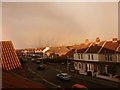
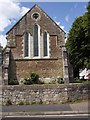
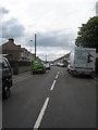
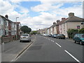
100 photos from this area
Area Information
Key information about the PO12 4HJ including its size, population, and administrative classification.
- Area Type
- Postcode
- Area Size
- 8289 m²
- Population
- 1495
- Population Density
- 6966 people/km²
House Prices in PO12 4HJ
24
Properties
£210,264
Average Sold Price
£62,500
Lowest Price
£345,000
Highest Price
Showing 24 properties
| Address | Type | Beds | Baths | Last Sale Price | Last Sale Date | |
|---|---|---|---|---|---|---|
| 72 Fisgard Road, Gosport, PO12 4HJ | Semi-detached | 3 | 1 | £345,000 | Sep 2024 | |
| 76 Fisgard Road, Gosport, PO12 4HJ | house | - | - | £285,000 | Jun 2022 | |
| 82 Fisgard Road, Gosport, PO12 4HJ | house | - | - | £237,000 | Feb 2021 | |
| 98 Fisgard Road, Gosport, PO12 4HJ | house | - | - | £272,500 | Dec 2020 | |
| 74 Fisgard Road, Gosport, PO12 4HJ | Semi-detached | 3 | 1 | £270,000 | Jun 2018 | |
| 100 Fisgard Road, Gosport, PO12 4HJ | Semi-detached | 3 | 1 | £249,950 | Dec 2017 | |
| 96 Fisgard Road, Gosport, PO12 4HJ | Semi-detached | 3 | 1 | £265,000 | Oct 2017 | |
| 80 Fisgard Road, Gosport, PO12 4HJ | Semi-detached | 3 | - | £176,000 | Jul 2014 | |
| 58 Fisgard Road, Gosport, PO12 4HJ | Semi-detached | - | - | £152,500 | Nov 2012 | |
| 86 Fisgard Road, Gosport, PO12 4HJ | house | - | - | £154,250 | Aug 2012 |
Page 1 of 3
Energy Efficiency in PO12 4HJ
Amenities
Schools
| Rank | School | Type | Entry gender | Ages |
|---|
Explore more schools in this area
Go to Schools tabDemographics
Household Size
Two person
most common
Accommodation Type
Houses
most common
Tenure
82
majority
Ethnic Group
White
most common
Religion
N/A
most common
Household Composition
N/A
most common
Age
47
median
Adults (30-64 years)
most common
Household Deprivation
N/A
with no deprivation
NS-SEC
31
in Lower managerial occupations
Explore more demographic insights in this area
Go to Demographics tabPlanning
Planning Constraints
- Flood RiskPremium
- Ramsar Wetland SitesPremium
- Area of Outstanding Natural BeautyPremium
- Protected Nature ReservePremium
- Protected WoodlandPremium