Area Overview for PO12 2HF
Photos of PO12 2HF
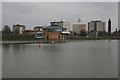
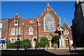
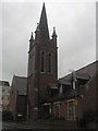
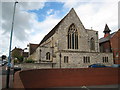
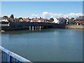
100 photos from this area
Area Information
Key information about the PO12 2HF including its size, population, and administrative classification.
- Area Type
- Postcode
- Area Size
- 1.1 hectares
- Population
- 1352
- Population Density
- 4575 people/km²
House Prices in PO12 2HF
21
Properties
£133,652
Average Sold Price
£40,000
Lowest Price
£280,000
Highest Price
Showing 21 properties
| Address | Type | Beds | Baths | Last Sale Price | Last Sale Date | |
|---|---|---|---|---|---|---|
| 14 Alver Bridge View, Gosport, PO12 2HF | house | 3 | 2 | £280,000 | May 2025 | |
| 22 Alver Bridge View, Gosport, PO12 2HF | house | 1 | - | £140,000 | Sep 2020 | |
| 16 Alver Bridge View, Gosport, PO12 2HF | Terraced | 3 | 1 | £202,000 | May 2019 | |
| 8 Alver Bridge View, Gosport, PO12 2HF | Flat | - | - | £104,700 | Dec 2018 | |
| 3 Alver Bridge View, Gosport, PO12 2HF | Terraced | 2 | - | £162,000 | Apr 2017 | |
| 15 Alver Bridge View, Gosport, PO12 2HF | Terraced | 4 | - | £219,950 | Aug 2015 | |
| 17 Alver Bridge View, Gosport, PO12 2HF | Terraced | 3 | - | £205,000 | Jul 2015 | |
| 20 Alver Bridge View, Gosport, PO12 2HF | house | - | - | £189,000 | Jul 2014 | |
| 2 Alver Bridge View, Gosport, PO12 2HF | Terraced | 2 | 1 | £125,000 | Jul 2013 | |
| 4 Alver Bridge View, Gosport, PO12 2HF | Terraced | 2 | - | £124,750 | Jul 2013 |
Page 1 of 3
Energy Efficiency in PO12 2HF
Amenities
Schools
| Rank | School | Type | Entry gender | Ages |
|---|
Explore more schools in this area
Go to Schools tabDemographics
Household Size
One person
most common
Accommodation Type
Houses
most common
Tenure
67
majority
Ethnic Group
White
most common
Religion
N/A
most common
Household Composition
N/A
most common
Age
47
median
Adults (30-64 years)
most common
Household Deprivation
N/A
with no deprivation
NS-SEC
30
in Lower managerial occupations
Explore more demographic insights in this area
Go to Demographics tabPlanning
Planning Constraints
- Flood RiskPremium
- Ramsar Wetland SitesPremium
- Area of Outstanding Natural BeautyPremium
- Protected Nature ReservePremium
- Protected WoodlandPremium