Area Overview for PO12 1PZ
Photos of PO12 1PZ
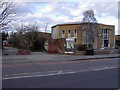
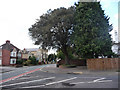
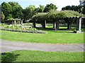
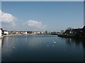
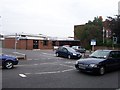
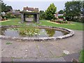
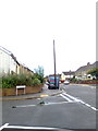
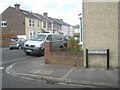
100 photos from this area
Area Information
Key information about the PO12 1PZ including its size, population, and administrative classification.
- Area Type
- Postcode
- Area Size
- 9595 m²
- Population
- 1192
- Population Density
- 9342 people/km²
House Prices in PO12 1PZ
50
Properties
£154,073
Average Sold Price
£44,000
Lowest Price
£243,000
Highest Price
Showing 50 properties
| Address | Type | Beds | Baths | Last Sale Price | Last Sale Date | |
|---|---|---|---|---|---|---|
| 110 Kings Road, Gosport, PO12 1PZ | Terraced | 2 | 1 | £233,000 | Aug 2024 | |
| 114 Kings Road, Gosport, PO12 1PZ | Terraced | 2 | 1 | £210,000 | Aug 2024 | |
| 100 Kings Road, Gosport, PO12 1PZ | Terraced | 2 | 2 | £200,000 | Jul 2024 | |
| 140 Kings Road, Gosport, PO12 1PZ | house | - | - | £185,000 | Apr 2024 | |
| 142 Kings Road, Gosport, PO12 1PZ | Terraced | 3 | 1 | £243,000 | May 2023 | |
| 112 Kings Road, Gosport, PO12 1PZ | Terraced | 2 | 2 | £228,000 | Jan 2023 | |
| 118 Kings Road, Gosport, PO12 1PZ | Terraced | 2 | 1 | £235,000 | Dec 2022 | |
| 128 Kings Road, Gosport, PO12 1PZ | house | - | - | £228,000 | Jun 2022 | |
| 132 Kings Road, Gosport, PO12 1PZ | Terraced | 3 | 1 | £225,000 | May 2022 | |
| 136 Kings Road, Gosport, PO12 1PZ | house | - | - | £236,000 | Mar 2021 |
Page 1 of 5
Energy Efficiency in PO12 1PZ
Amenities
Schools
| Rank | School | Type | Entry gender | Ages |
|---|
Explore more schools in this area
Go to Schools tabDemographics
Household Size
Two person
most common
Accommodation Type
Houses
most common
Tenure
77
majority
Ethnic Group
White
most common
Religion
N/A
most common
Household Composition
N/A
most common
Age
47
median
Adults (30-64 years)
most common
Household Deprivation
N/A
with no deprivation
NS-SEC
33
in Lower managerial occupations
Explore more demographic insights in this area
Go to Demographics tabPlanning
Planning Constraints
- Flood RiskPremium
- Ramsar Wetland SitesPremium
- Area of Outstanding Natural BeautyPremium
- Protected Nature ReservePremium
- Protected WoodlandPremium