Area Overview for PO12 1EP
Photos of PO12 1EP


Area Information
Living in PO12 1EP means settling into a compact residential cluster covering just 21.8 hectares. With a population of 1,144 people, this small postcode area offers an enclosed neighbourhood feel where residents know their surroundings clearly. The space is dense, hosting 5,259 people per square kilometre, which creates immediate proximity between houses but limits open green space within the boundary itself. You will find yourself in a community defined by its density rather than sprawling estates or wide boulevards. The area serves its residents as a self-contained pocket of Portsmouth, functioning as a specific slice of the larger port city rather than a standalone town. Daily life here revolves around walking distances to nearby hubs, as the small footprint means everything is clustered closely together. This density provides convenience but also means you should expect higher population concentrations compared to rural suburbs. The character of PO12 1EP is practical, focusing on efficient living within a limited geographical zone. Prospective buyers are entering a micro-community where interaction with neighbours is more likely due to the sheer number of households packed into such a small land area.
- Area Type
- Postcode
- Area Size
- 21.8 hectares
- Population
- 1144
- Population Density
- 5858 people/km²
You can expect to find flats as the predominant form of housing within PO12 1EP, dictated by the need to fit 1,144 people into 21.8 hectares of land. This concentration of flats defines the local estate character and influences how property values and rentals operate in the zone. With just 43% home ownership rates, you are looking at a market where leasehold properties or rental units may be more common than bungalows or detached houses found in less dense boroughs. The high population density means interiors in these units might be smaller, compensating for the lack of extensive private outdoor space. Buyers should consider that this is a high-density living environment where space is at a premium. The mix of ownership types suggests a dynamic market where landlords and buyers compete for specific flat units. This is not a sea of semi-detached homes, but rather a vertical living arrangement suited to a bustling urban pocket. The area functions as a residential hub for Portsmouth rather than a standalone suburb with large gardens. Property here serves a specific niche of urban dwellers who prioritise location over extensive grounds.
House Prices in PO12 1EP
Showing 2 properties
| Address | Type | Beds | Baths | Last Sale Price | Last Sale Date | |
|---|---|---|---|---|---|---|
| Bus Station, South Street, Gosport, PO12 1EP | commercial | - | - | - | - | |
| Pc Falklands Gardens, South Street, Gosport, PO12 1EP | commercial | - | - | - | - |
Energy Efficiency in PO12 1EP
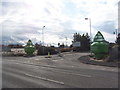
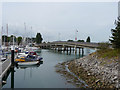
Residents of PO12 1EP have excellent access to transport links, with five ferries and five rail stations within practical reach. You can catch services at Portsmouth Harbour Railway Station, Southsea Hoverport, and Portsmouth & Southsea Railway Station without needing your own car for daily commutes. Ferry options include Portsmouth Harbour Station Pier, Gosport Ferry Terminal, and Portsmouth Millennium Pontoon, giving you multiple routes to Isle of Wight or mainland connections. Local shopping is similarly convenient, with M&S Gunwharf, The Southern Co-operative Co, and Aldi Gosport situated nearby for grocery and retail needs. These amenities are close enough to walk to or reach quickly by public transport. The area also sees visitors to Smallbrook Junction, part of the Isle of Wight Steam Railway, adding a leisure element for rail enthusiasts. This cluster of amenities supports a lifestyle where you do not need extensive driving for basic needs. Daily errands involving food, transport, or commuting are streamlined by this proximity. You enjoy the convenience of a port city edge without the immediate isolation of remote inland villages.
Amenities
Schools
| Rank | School | Type | Entry gender | Ages |
|---|
Explore more schools in this area
Go to Schools tabDemographics
The community in PO12 1EP reflects a mature population profile with a median age of 47 years. Most residents fall into the adult bracket between 30 and 64 years old, indicating a neighbourhood dominated by workers and families who have already established themselves. Only 43% of households own their accommodation outright, meaning well over half of the residents are likely tenants or live with family support. This figure suggests a significant rental market component alongside owner-occupied properties. The housing stock consists primarily of flats, which aligns with the high population density of 5,259 people per square kilometre. This accommodation type serves the area's compact footprint efficiently. The predominant ethnic group is White, establishing the area as having a traditional demographic makeup. There are no younger children under 15 forming a large demographic block, nor is there a heavy concentration of under-30s looking for their first home. This age structure implies stability, with adults seeking established housing rather than high-rise student blocks or temporary rentals.
Household Size
Accommodation Type
Tenure
Ethnic Group
Religion
Household Composition
Age
Household Deprivation
NS-SEC
Explore more demographic insights in this area
Go to Demographics tabPlanning
Planning Constraints
- Flood RiskPremium
- Ramsar Wetland SitesPremium
- Area of Outstanding Natural BeautyPremium
- Protected Nature ReservePremium
- Protected WoodlandPremium