Area Overview for PO11 9PT
Photos of PO11 9PT
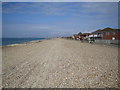
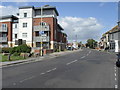
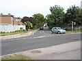
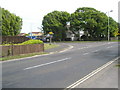
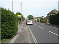
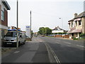
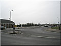
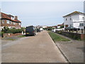
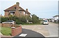
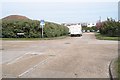
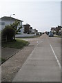
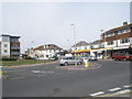
100 photos from this area
Area Information
Key information about the PO11 9PT including its size, population, and administrative classification.
- Area Type
- Postcode
- Area Size
- 3.9 hectares
- Population
- 1475
- Population Density
- 2803 people/km²
House Prices in PO11 9PT
33
Properties
£314,401
Average Sold Price
£81,250
Lowest Price
£570,000
Highest Price
Showing 33 properties
| Address | Type | Beds | Baths | Last Sale Price | Last Sale Date | |
|---|---|---|---|---|---|---|
| 47 Southwood Road, Hayling Island, PO11 9PT | Detached | 5 | 2 | £510,000 | Nov 2022 | |
| 35 Southwood Road, Hayling Island, PO11 9PT | Retail | 2 | 1 | £354,265 | Jul 2022 | |
| 71 Southwood Road, Hayling Island, PO11 9PT | Detached | 4 | 1 | £570,000 | Feb 2022 | |
| 63 Southwood Road, Hayling Island, PO11 9PT | Detached | 4 | 2 | £505,000 | Sep 2021 | |
| 67A Southwood Road, Hayling Island, PO11 9PT | Bungalow | - | - | £505,000 | Sep 2021 | |
| 79 Southwood Road, Hayling Island, PO11 9PT | Semi-detached | 3 | 2 | £322,500 | Aug 2020 | |
| 77 Southwood Road, Hayling Island, PO11 9PT | Semi-detached | 3 | - | £269,000 | Feb 2015 | |
| 51 Southwood Road, Hayling Island, PO11 9PT | Detached | 4 | - | £290,000 | Mar 2013 | |
| 73 Southwood Road, Hayling Island, PO11 9PT | Semi-detached | 3 | 3 | £225,000 | Feb 2010 | |
| 75 Southwood Road, Hayling Island, PO11 9PT | Bungalow | 3 | - | £204,000 | Nov 2005 |
Page 1 of 4
Energy Efficiency in PO11 9PT
Amenities
Schools
| Rank | School | Type | Entry gender | Ages |
|---|
Explore more schools in this area
Go to Schools tabDemographics
Household Size
Two person
most common
Accommodation Type
Houses
most common
Tenure
67
majority
Ethnic Group
White
most common
Religion
N/A
most common
Household Composition
N/A
most common
Age
47
median
Adults (30-64 years)
most common
Household Deprivation
N/A
with no deprivation
NS-SEC
28
in Lower managerial occupations
Explore more demographic insights in this area
Go to Demographics tabPlanning
Planning Constraints
- Flood RiskPremium
- Ramsar Wetland SitesPremium
- Area of Outstanding Natural BeautyPremium
- Protected Nature ReservePremium
- Protected WoodlandPremium