Area Overview for PO11 9BL
Photos of PO11 9BL
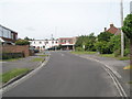
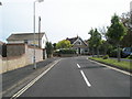
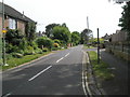
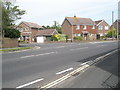
100 photos from this area
Area Information
Key information about the PO11 9BL including its size, population, and administrative classification.
- Area Type
- Postcode
- Area Size
- 4875 m²
- Population
- 1548
- Population Density
- 2954 people/km²
House Prices in PO11 9BL
10
Properties
£113,000
Average Sold Price
£85,000
Lowest Price
£155,000
Highest Price
Showing 10 properties
| Address | Type | Beds | Baths | Last Sale Price | Last Sale Date | |
|---|---|---|---|---|---|---|
| 26 Mengham Road, Hayling Island, PO11 9BL | Flat | - | - | £155,000 | Mar 2018 | |
| 42 Mengham Road, Hayling Island, PO11 9BL | Flat | 2 | 1 | £110,000 | Feb 2018 | |
| 24 Mengham Road, Hayling Island, PO11 9BL | Flat | 2 | 1 | £102,000 | Jun 2015 | |
| 44 Mengham Road, Hayling Island, PO11 9BL | Flat | 2 | 1 | £85,000 | Oct 2013 | |
| 20A Mengham Road, Hayling Island, PO11 9BL | Flat | 2 | 1 | - | - | |
| Flat, 26 Mengham Road, Hayling Island, PO11 9BL | Flat | - | - | - | - | |
| 14A Mengham Road, Hayling Island, PO11 9BL | Flat | - | - | - | - | |
| 38 Mengham Road, Hayling Island, PO11 9BL | retail_financial | - | - | - | - | |
| All About Feet, 46 Mengham Road, Hayling Island, PO11 9BL | retail_financial | - | - | - | - | |
| 18A Mengham Road, Hayling Island, PO11 9BL | Flat | - | - | - | - |
Energy Efficiency in PO11 9BL
Amenities
Schools
| Rank | School | Type | Entry gender | Ages |
|---|
Explore more schools in this area
Go to Schools tabDemographics
Household Size
Two person
most common
Accommodation Type
Houses
most common
Tenure
76
majority
Ethnic Group
White
most common
Religion
N/A
most common
Household Composition
N/A
most common
Age
47
median
Adults (30-64 years)
most common
Household Deprivation
N/A
with no deprivation
NS-SEC
34
in Lower managerial occupations
Explore more demographic insights in this area
Go to Demographics tabPlanning
Planning Constraints
- Flood RiskPremium
- Ramsar Wetland SitesPremium
- Area of Outstanding Natural BeautyPremium
- Protected Nature ReservePremium
- Protected WoodlandPremium