Area Overview for PO11 0RT
Photos of PO11 0RT
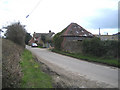


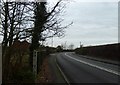


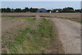
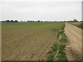


43 photos from this area
Area Information
Key information about the PO11 0RT including its size, population, and administrative classification.
- Area Type
- Postcode
- Area Size
- 33.6 hectares
- Population
- 1302
- Population Density
- 254 people/km²
House Prices in PO11 0RT
39
Properties
£501,476
Average Sold Price
£70,000
Lowest Price
£1,570,000
Highest Price
Showing 39 properties
| Address | Type | Beds | Baths | Last Sale Price | Last Sale Date | |
|---|---|---|---|---|---|---|
| Clamshells, St Peters Road, Hayling Island, PO11 0RT | Semi-detached | 3 | - | £492,000 | Dec 2023 | |
| North Cottage, St Peters Road, Hayling Island, PO11 0RT | house | - | - | £500,000 | Aug 2023 | |
| Spinners, St Peters Road, Hayling Island, PO11 0RT | house | - | - | £489,995 | Aug 2021 | |
| The Willows, St Peters Road, Hayling Island, PO11 0RT | Detached | 4 | 2 | £1,570,000 | Jun 2021 | |
| Eastney Cottage, St Peters Road, Hayling Island, PO11 0RT | Semi-detached | 4 | 3 | £550,000 | Mar 2021 | |
| Sunnyfields, St Peters Road, Hayling Island, PO11 0RT | Bungalow | 4 | - | £1,135,000 | Feb 2021 | |
| Fernbank House, St Peters Road, Hayling Island, PO11 0RT | Detached | 4 | 2 | £650,000 | Nov 2020 | |
| Fieldside, St Peters Road, Hayling Island, PO11 0RT | Detached | 4 | 3 | £570,000 | Mar 2020 | |
| Cherry Hinton, St Peters Road, Hayling Island, PO11 0RT | Bungalow | 3 | 2 | £410,000 | Nov 2019 | |
| Seven Stones, St Peters Road, Hayling Island, PO11 0RT | Detached | 4 | 2 | £602,000 | Oct 2014 |
Page 1 of 4
Energy Efficiency in PO11 0RT
Amenities
Schools
| Rank | School | Type | Entry gender | Ages |
|---|
Explore more schools in this area
Go to Schools tabDemographics
Household Size
Two person
most common
Accommodation Type
Houses
most common
Tenure
69
majority
Ethnic Group
White
most common
Religion
N/A
most common
Household Composition
N/A
most common
Age
47
median
Adults (30-64 years)
most common
Household Deprivation
N/A
with no deprivation
NS-SEC
33
in Lower managerial occupations
Explore more demographic insights in this area
Go to Demographics tabPlanning
Planning Constraints
- Flood RiskPremium
- Ramsar Wetland SitesPremium
- Area of Outstanding Natural BeautyPremium
- Protected Nature ReservePremium
- Protected WoodlandPremium