Area Overview for PO11 0HN
Photos of PO11 0HN
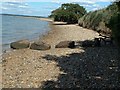
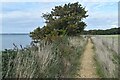
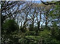

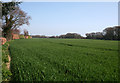


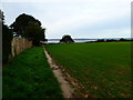
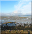
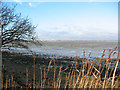
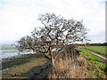
24 photos from this area
Area Information
Key information about the PO11 0HN including its size, population, and administrative classification.
- Area Type
- Postcode
- Area Size
- 83.3 hectares
- Population
- 1367
- Population Density
- 530 people/km²
House Prices in PO11 0HN
33
Properties
£580,571
Average Sold Price
£87,500
Lowest Price
£1,490,000
Highest Price
Showing 33 properties
| Address | Type | Beds | Baths | Last Sale Price | Last Sale Date | |
|---|---|---|---|---|---|---|
| 43 North Shore Road, Hayling Island, PO11 0HN | Retail | 5 | 3 | £1,150,000 | May 2023 | |
| The Curlews, 49 North Shore Road, Hayling Island, PO11 0HN | house | - | - | £1,490,000 | Oct 2021 | |
| 55 North Shore Road, Hayling Island, PO11 0HN | house | - | - | £740,000 | Jun 2021 | |
| 56 North Shore Road, Hayling Island, PO11 0HN | Detached | 5 | 2 | £695,000 | Jun 2021 | |
| 51 North Shore Road, Hayling Island, PO11 0HN | Detached | 3 | 3 | £1,060,000 | Apr 2021 | |
| 34 North Shore Road, Hayling Island, PO11 0HN | Detached | 5 | 2 | £680,000 | Jul 2017 | |
| 32 North Shore Road, Hayling Island, PO11 0HN | Detached | 4 | 1 | £519,000 | Dec 2016 | |
| 52 North Shore Road, Hayling Island, PO11 0HN | house | 3 | - | £460,000 | Nov 2016 | |
| 35 North Shore Road, Hayling Island, PO11 0HN | Bungalow | - | - | £725,000 | Mar 2016 | |
| 53 North Shore Road, Hayling Island, PO11 0HN | house | - | - | £880,000 | Mar 2016 |
Page 1 of 4
Energy Efficiency in PO11 0HN
Amenities
Schools
| Rank | School | Type | Entry gender | Ages |
|---|
Explore more schools in this area
Go to Schools tabDemographics
Household Size
Two person
most common
Accommodation Type
Houses
most common
Tenure
94
majority
Ethnic Group
White
most common
Religion
N/A
most common
Household Composition
N/A
most common
Age
47
median
Elderly (65+ years)
most common
Household Deprivation
N/A
with no deprivation
NS-SEC
48
in Lower managerial occupations
Explore more demographic insights in this area
Go to Demographics tabPlanning
Planning Constraints
- Flood RiskPremium
- Ramsar Wetland SitesPremium
- Area of Outstanding Natural BeautyPremium
- Protected Nature ReservePremium
- Protected WoodlandPremium