Area Overview for PO11 0ER
Photos of PO11 0ER
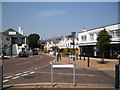
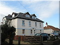
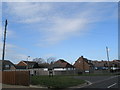
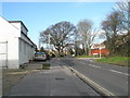
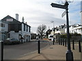
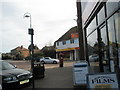
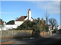

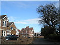
100 photos from this area
Area Information
Key information about the PO11 0ER including its size, population, and administrative classification.
- Area Type
- Postcode
- Area Size
- 1.7 hectares
- Population
- 1367
- Population Density
- 530 people/km²
House Prices in PO11 0ER
24
Properties
£254,663
Average Sold Price
£128,000
Lowest Price
£375,000
Highest Price
Showing 24 properties
| Address | Type | Beds | Baths | Last Sale Price | Last Sale Date | |
|---|---|---|---|---|---|---|
| 10 Richmond Close, Hayling Island, PO11 0ER | house | - | - | £285,000 | Sep 2025 | |
| 15 Richmond Close, Hayling Island, PO11 0ER | Semi-detached | 2 | 1 | £375,000 | Mar 2025 | |
| 12 Richmond Close, Hayling Island, PO11 0ER | house | - | - | £307,500 | Oct 2020 | |
| 22 Richmond Close, Hayling Island, PO11 0ER | house | - | - | £315,000 | Oct 2020 | |
| 21 Richmond Close, Hayling Island, PO11 0ER | Semi-detached | 3 | 1 | £207,000 | Jan 2017 | |
| 18 Richmond Close, Hayling Island, PO11 0ER | Semi-detached | 3 | 1 | £282,000 | Oct 2016 | |
| 11 Richmond Close, Hayling Island, PO11 0ER | house | - | - | £269,000 | Sep 2016 | |
| 1 Richmond Close, Hayling Island, PO11 0ER | house | 4 | - | £311,000 | May 2015 | |
| 4 Richmond Close, Hayling Island, PO11 0ER | Detached | 4 | - | £247,500 | Feb 2014 | |
| 14 Richmond Close, Hayling Island, PO11 0ER | Bungalow | 3 | - | £315,000 | Mar 2012 |
Page 1 of 3
Energy Efficiency in PO11 0ER
Amenities
Schools
| Rank | School | Type | Entry gender | Ages |
|---|
Explore more schools in this area
Go to Schools tabDemographics
Household Size
Two person
most common
Accommodation Type
Houses
most common
Tenure
94
majority
Ethnic Group
White
most common
Religion
N/A
most common
Household Composition
N/A
most common
Age
47
median
Elderly (65+ years)
most common
Household Deprivation
N/A
with no deprivation
NS-SEC
48
in Lower managerial occupations
Explore more demographic insights in this area
Go to Demographics tabPlanning
Planning Constraints
- Flood RiskPremium
- Ramsar Wetland SitesPremium
- Area of Outstanding Natural BeautyPremium
- Protected Nature ReservePremium
- Protected WoodlandPremium