Area Overview for PO11 0BG
Photos of PO11 0BG
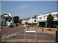
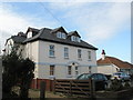
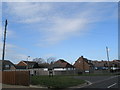
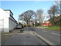
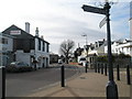
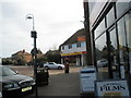
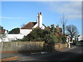
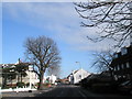
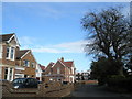
100 photos from this area
Area Information
Key information about the PO11 0BG including its size, population, and administrative classification.
- Area Type
- Postcode
- Area Size
- 1.1 hectares
- Population
- 1468
- Population Density
- 2495 people/km²
House Prices in PO11 0BG
14
Properties
£416,813
Average Sold Price
£312,000
Lowest Price
£705,000
Highest Price
Showing 14 properties
| Address | Type | Beds | Baths | Last Sale Price | Last Sale Date | |
|---|---|---|---|---|---|---|
| 12 Green Lane, Hayling Island, PO11 0BG | Detached | 4 | - | £705,000 | Aug 2025 | |
| 6 Green Lane, Hayling Island, PO11 0BG | Bungalow | 3 | - | £400,000 | May 2024 | |
| 4 Green Lane, Hayling Island, PO11 0BG | Detached | 4 | 3 | £422,500 | Feb 2021 | |
| 3 Green Lane, Hayling Island, PO11 0BG | Bungalow | - | - | £312,000 | Aug 2019 | |
| 9 Green Lane, Hayling Island, PO11 0BG | Bungalow | 3 | 2 | £380,000 | Nov 2017 | |
| 8 Green Lane, Hayling Island, PO11 0BG | Bungalow | - | - | £365,000 | Nov 2014 | |
| 7 Green Lane, Hayling Island, PO11 0BG | house | - | - | £340,000 | Sep 2013 | |
| 18 Green Lane, Hayling Island, PO11 0BG | house | - | - | £410,000 | Jun 2009 | |
| 2 Green Lane, Hayling Island, PO11 0BG | Chalet | 4 | - | - | - | |
| 16 Green Lane, Hayling Island, PO11 0BG | Detached | - | - | - | - |
Page 1 of 2
Energy Efficiency in PO11 0BG
Amenities
Schools
| Rank | School | Type | Entry gender | Ages |
|---|
Explore more schools in this area
Go to Schools tabDemographics
Household Size
One person
most common
Accommodation Type
Flats
most common
Tenure
51
majority
Ethnic Group
White
most common
Religion
N/A
most common
Household Composition
N/A
most common
Age
47
median
Elderly (65+ years)
most common
Household Deprivation
N/A
with no deprivation
NS-SEC
31
in Lower managerial occupations
Explore more demographic insights in this area
Go to Demographics tabPlanning
Planning Constraints
- Flood RiskPremium
- Ramsar Wetland SitesPremium
- Area of Outstanding Natural BeautyPremium
- Protected Nature ReservePremium
- Protected WoodlandPremium