Area Overview for PO10 8JU
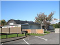
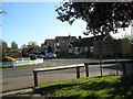
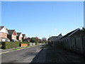
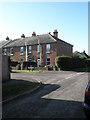
Photos of PO10 8JU
Area Information
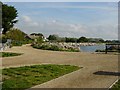
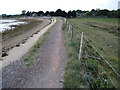
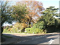
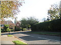
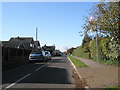
Living in PO10 8JU means residing in a specific postcode area that covers a small residential cluster on the English coast. The community currently consists of 2,093 residents, which creates a manageable environment for settled living. With a population density of 745 people per square kilometre, the vicinity maintains a balance between proximity to neighbours and a reasonable degree of privacy. The location offers a stable home for adults rather than a transient hub, as the demographic profile strongly favours households aged between 30 and 64 years. This concentration ensures the area functions as a quiet domestic zone where daily life revolves around local routines rather than commercial intensity. You will find a neighbourhood character defined by stability, where the majority of residents have made long-term commitments to their properties. The small size of this cluster limits large-scale development pressures while retaining access to the wider Southbourne region. Localised connectivity allows you to move easily to nearby villages without feeling isolated from the broader South Downs network. This postcode serves as a tightly knit pocket of the coast, ideal for those seeking a quiet retreat with defined boundaries.
- Area Type
- Postcode
- Area Size
- Not available
- Population
- 2093
- Population Density
- 745 people/km²
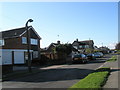
The property market in PO10 8JU is characterised by a static housing stock dominated by houses rather than flats or apartments. This predominance of detached and semi-detached dwellings suggests an area built for family living and retirement rather than urban density. With 77% of residents owning their homes, the local market behaves like a traditional homeownership zone where transaction volumes typically reflect life-cycle events such as inheritance, retirement, or death. Buyers browsing homes in PO10 8JU should expect chalets, bungalows, or larger family homes rather than high-rise conversions or modern studio blocks. The high ownership rate implies that mortgage stress is lower here than in rental-heavy districts, as local wealth is trapped within property equity. You will rarely find speculative development projects disrupting this layout because the land is already packaged for existing owners. This stability makes purchasing a straightforward process, with fewer complications regarding leasehold restrictions or service charges. However, the specific nature of this small postcode means your options are limited to what continues to exist rather than a wide selection of new builds. Your search will focus on established properties that have withstood decades of coastal weathering.
House Prices in PO10 8JU
No properties found in this postcode.
Energy Efficiency in PO10 8JU
Residents of PO10 8JU enjoy immediate access to five retail outlets, including The Southern Co-operative Co and Tesco Southbourne. These shops form the commercial heart of the area, allowing you to handle weekly shopping and household errands without needing to drive to Worthing or Goring-by-Sea. You can fill your car boot at The Southern Co-operative Co while your children play near the car park or browse seasonal fresh produce at Tesco Southbourne. Beyond groceries, the area offers three ferry landing points at Bosham Hoe, West Itchenor, and Hayling Island. These crossings provide unique recreational routes to the Chichester Harbour and the South Sea coast, enabling weekend sailing or beach walks without a ferry ticket to the mainland. Five railway stations within practical reach give you flexibility when travelling for leisure. You might choose Southbourne Railway Station for a quick trip to Brighton or Emsworth Railway Station for a heritage train experience. This mix of coastal ferries and overland rail gives you the freedom to choose scenery for your weekend escape.
Amenities
Schools
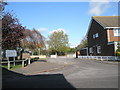
Families living in PO10 8JU benefit from immediate access to two primary schools, both holding an Ofsted rating of good. Southbourne Infant School serves the younger children in the cluster, while Southbourne Junior School takes on the responsibility for juniors within the same local authority network. This dual facility arrangement allows students to stay within the immediate neighbourhood as they progress through their education, reducing travel times and maintaining social roots. Both institutions share the same reputation for quality, offering consistent educational standards without the disruption of moving between different academy trusts or free schools. Parents prioritising proximity will find that their children rarely need to commute far to reach a classroom of their age group. The combination of infant and junior provision under the Southbourne umbrella simplifies parental decision-making regarding primary education choices. You can enrol your child in a green-field-primary style environment that values local heritage and community integration. School attendance figures are strong, and the catchment areas for these two venues likely encompass the entirety of this small postcode cluster.
| Rank | School | Type | Entry gender | Ages |
|---|
Explore more schools in this area
Go to Schools tabDemographics
The social fabric of PO10 8JU is defined by a mature population with a median age of 47 years. This figure indicates that the residents skew older than the national average, reflecting a community where stability takes precedence over rapid change. The most common age range comprises adults between 30 and 64 years, meaning the area supports families with older children as well as empty-nesters and retirees. Home ownership stands at an impressive 77%, a statistic that reveals a community where people have invested deeply in their local roots. Tenure reliability here means you are buying into a local knowledge network rather than entering a volatile rental market. Children in the area will predominantly grow up in households where parents hold their properties free from landlord interference. The ethnic composition is overwhelmingly White, which contributes to a culturally cohesive and homogeneous neighbourhood environment. Accommodation types focus almost exclusively on houses, ensuring that families and those seeking land have ample space for gardens and extensions. Every house in this cluster represents a element of a larger picture of settled, owner-occupied living.
Household Size
Accommodation Type
Tenure
Ethnic Group
Religion
Household Composition
Age
Household Deprivation
NS-SEC
Explore more demographic insights in this area
Go to Demographics tabPlanning
Planning Constraints
- Flood RiskPremium
- Ramsar Wetland SitesPremium
- Area of Outstanding Natural BeautyPremium
- Protected Nature ReservePremium
- Protected WoodlandPremium