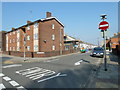
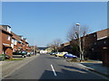
Area Overview for PO1 5EE
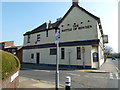
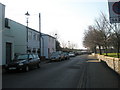
Photos of PO1 5EE
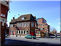
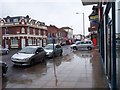

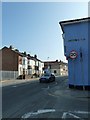
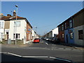


Area Information
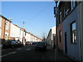
Living in PO1 5EE means residing within a specific residential cluster covering 2850 square metres. This small postcode area forms part of the broader Portsmouth landscape, offering a contained community feel for those seeking a defined neighbourhood. The total population stands at 2052 people, creating a tight-knit environment where residents often know their neighbours. Daily life here revolves around a mix of quiet residential streets and proximity to key city infrastructure. The location serves as a practical base for accessing major travel hubs and retail centres without the sprawling commute typical of larger metropolitan zones. You benefit from being close to Portsmouth International Cruise & Ferry Terminal while remaining within easy reach of supermarkets and local shops. The area combines the convenience of urban access with the stability of a smaller housing cluster. For homebuyers, this postcode represents a choice of living in Portsmouth on a manageable scale. The population density reflects a concentrated community rather than a dispersed suburb. While the area size is small, the strategic positioning ensures access to essential services and transport links. This makes PO1 5EE a viable option for households prioritising location efficiency over extensive garden space or large plots of land.
- Area Type
- Postcode
- Area Size
- 2850 m²
- Population
- 2052
- Population Density
- 15895 people/km²
The housing stock in PO1 5EE is defined by a focus on houses rather than apartments or high-rise flats. This preference for detached or semi-detached properties appeals to buyers seeking traditional home ownership models. With home ownership standing at 37%, the market balances between professionals purchasing their first home and long-term residents looking to trade up or down. This ownership rate indicates that while many people live here, a significant portion of the rental market remains active. For those considering homes in PO1 5EE, this suggests a diverse inventory where you might find both private landlords and owners wishing to sell. The predominance of houses means you are likely looking for properties with private gardens, driveway space, or larger internal layouts suitable for a 30 to 64 age group. Given the small area size of 2850 square metres, supply is naturally limited. This constraint often drives competition among buyers who have identified the right property. You may face a market where viewing options are few but potentially high in value if the house meets your requirements. The area does not cater to those seeking vast new-build developments or large estates.
House Prices in PO1 5EE
Showing 15 properties
| Address | Type | Beds | Baths | Last Sale Price | Last Sale Date | |
|---|---|---|---|---|---|---|
| 16 Penhale Road, Portsmouth, PO1 5EE | house | - | - | £140,000 | Apr 2023 | |
| 9 Penhale Road, Portsmouth, PO1 5EE | Terraced | 3 | 1 | £280,000 | Dec 2022 | |
| 8 Penhale Road, Portsmouth, PO1 5EE | Terraced | 2 | 1 | £230,000 | Oct 2022 | |
| 6 Penhale Road, Portsmouth, PO1 5EE | house | - | - | £190,000 | Oct 2021 | |
| 12 Penhale Road, Portsmouth, PO1 5EE | Terraced | 2 | 1 | £180,000 | Jun 2019 | |
| 13 Penhale Road, Portsmouth, PO1 5EE | Terraced | 3 | 1 | £215,250 | Sep 2016 | |
| 10 Penhale Road, Portsmouth, PO1 5EE | Semi-detached | 4 | 2 | £168,000 | Aug 2016 | |
| 3 Penhale Road, Portsmouth, PO1 5EE | Terraced | 1 | 2 | £152,000 | Mar 2016 | |
| 7 Penhale Road, Portsmouth, PO1 5EE | Terraced | 3 | - | £154,200 | Jan 2015 | |
| 5 Penhale Road, Portsmouth, PO1 5EE | house | - | - | £162,000 | Sep 2011 |
Energy Efficiency in PO1 5EE
Life in PO1 5EE centres on convenience and access to major retail and leisure hubs. You have five notable retail options within easy reach, ensuring daily shopping needs are met without long journeys. Farmfoods Fratton, Asda Portsmouth, and Spar provide everything from fresh groceries to household essentials. These supermarkets form the backbone of daily shopping routines for residents. Transport-centric lifestyle features further enhance your options. With five railway stations and five ferry terminals nearby, you can treat the area as a gateway to wider travel. Portsmouth International Cruise & Ferry Terminal serves both passengers and car ferries, while Portsmouth Harbour Railway Station and Fratton Railway Station offer commuter links. This level of connectivity brings a semi-urban lifestyle to the doorstep of your home. Although the area lacks dedicated parks or leisure centres listed in the immediate data, the proximity to Portsmouth's central amenities means you can enjoy cinema visits, theatre performances, or sports events with minimal travel. The presence of Spar and Asda also implies proximity to other local services often found alongside major retail outlets. Living in PO1 5EE means you enjoy the benefits of city living without the congestion, thanks to efficient transport links and reliable access to everyday goods.
Amenities
Schools
Families living near PO1 5EE have access to several educational institutions within practical reach. Penhale Infant School & Nursery and Penbridge Infant School & Nursery both offer primary education for younger children. These academies and nursery schools provide early learning within a short distance from the residential cluster. The North End Centre is another notable facility nearby, though its classification as 'other' suggests it may serve a non-traditional educational or community purpose rather than primary or secondary schooling. You will need to contact the centre directly to understand its specific educational offerings. For residents with children, the presence of two infant schools means you do not have multiple options from which to choose depending on exact location within the postcode. Schools near PO1 5EE are therefore a fixed part of the local landscape. While there is no secondary school listed in the immediate vicinity of this small postcode, the existence of well-established primary providers indicates a functioning local system. Families planning to stay in PO1 5EE should ensure their older children's education needs are met by checking transport links to secondary schools beyond the immediate neighbourhood.
| Rank | School | Type | Entry gender | Ages |
|---|
Explore more schools in this area
Go to Schools tabDemographics
The community in PO1 5EE reflects the needs of established households rather than young families or students. The median age is 47, placing the demographic centre well into adulthood. Most residents fall within the 30 to 64 age range, indicating a stable population with significant working-age presence. This mature demographic profile suggests the area attracts buyers seeking stability and quiet living environments. Home ownership rates sit at 37%, meaning slightly less than half of the households rent their homes. The remaining proportion comprises owner-occupiers who have likely built long-term roots in the neighbourhood. Accommodation types consist primarily of houses, suggesting a preference for single-family dwellings over flats or terraced property. The predominant ethnic group is White, aligning with the broader pattern seen across much of the country. With a population of 2052, the community maintains a character shaped by long-term residents. You will find a neighbourhood where the majority of people have lived beyond their early 30s. This age structure often correlates with specific lifestyle choices, such as prioritising safety, space, and reliable local amenities over nightlife or student-oriented facilities.
Household Size
Accommodation Type
Tenure
Ethnic Group
Religion
Household Composition
Age
Household Deprivation
NS-SEC
Explore more demographic insights in this area
Go to Demographics tabPlanning
Planning Constraints
- Flood RiskPremium
- Ramsar Wetland SitesPremium
- Area of Outstanding Natural BeautyPremium
- Protected Nature ReservePremium
- Protected WoodlandPremium