Area Overview for PO1 5AN
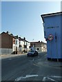
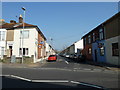
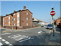
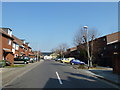
Photos of PO1 5AN


Area Information
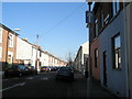
The postcode PO1 5AN defines a small residential cluster in Portsmouth with a precise physical footprint of 4,103 square metres. Despite its compact size, this location houses 2,052 people, resulting in a very high population density of 500,092 people per square kilometre. This concentration indicates a tightly knit neighbourhood where daily movements bring residents in close contact with their immediate neighbours. Living in PO1 5AN means navigating a dense urban environment rather than sprawling suburbs. The area functions as a specific cluster within the wider city, offering a distinct slice of life characterised by high occupancy rates. For any prospective buyer, understanding this scale is essential, as the limited land area shapes the availability of housing and the intensity of the community. You experience a neighbourhood where convenience comes from proximity, but space is at a premium. The sheer density suggests a lively, active environment where local infrastructure must serve a large number of inhabitants simultaneously.
- Area Type
- Postcode
- Area Size
- 4103 m²
- Population
- 2052
- Population Density
- 15895 people/km²
Homes in PO1 5AN are primarily detached properties or large houses, as the accommodation type data confirms the presence of houses rather than flats or maisonettes. With a 37% home ownership rate, the area sees a significant portion of residents living in rental properties or homes still under mortgage. This mix suggests a market that accommodates both long-term owners seeking stability and those looking to rent rather than commit to a property purchase. The small total area of 4,103 square metres restricts the number of individual properties available, which can drive competition for specific locations within the cluster. You will find that the housing stock is defined by its traditional nature and density. Buyers should consider that while houses dominate, the higher rental proportion means the market remains accessible to those unable to purchase immediately. The compact nature of the postcode means land values and property prices are tightly constrained by space limitations.
House Prices in PO1 5AN
Showing 27 properties
Energy Efficiency in PO1 5AN
Daily life in PO1 5AN is defined by the convenience of major amenities located just a short drive away. Residents can shop regularly at Asda Portsmouth, Lidl Southsea, and Aldi Fratton Way, all of which are listed as notable retail locations within practical reach. Dining and casual stops are abundant in the Southsea and Fratton vicinity. Transport links include five nearby rail stations, enabling quick commutes to Portsmouth, Brighton, or London. The area also offers five ferry terminals, including the Portsmouth International Cruise & Ferry Terminal and the Portsmouth IOW Car Ferry Terminal, adding significant travel flexibility. These transport arteries keep PO1 5AN connected to Hampshire, Dorset, and beyond. Living in this postcode means you do not need to travel far for large supermarkets or leisure facilities. The concentration of these services creates a lifestyle where errands are quick and transit is frequent. You enjoy the convenience of major retail chains without leaving the immediate city limits.
Amenities
Schools
Families settling in PO1 5AN have access to three specific educational institutions within practical reach. The North End Centre serves as a community hub for youth activities, while Penhale Infant School & Nursery and Penbridge Infant School & Nursery provide primary education. Penbridge operates as an academy, offering a state-funded curriculum under specific governance, whereas Penhale remains a standard community school. For young children, both infant schools cater to early years and reception through lower key stages. The presence of these specific facilities ensures that children living near PO1 5AN can access local education without needing to travel further afield. Penhale & Penbridge are highly rated for their local provision, though official Ofsted ratings are not included in the current data scope. This concentration of schools signals a catchment area designed for local families. However, the limited school list indicates that older children may need to look beyond these specific institutions for secondary education.
| Rank | School | Type | Entry gender | Ages |
|---|
Explore more schools in this area
Go to Schools tabDemographics
The community in PO1 5AN is dominated by adults aged between 30 and 64 years, who form the most common age range. This demographic profile indicates a mature population, with a median age of 47 years. The area consists exclusively of houses, reflecting a bias towards traditional family or long-term living arrangements rather than flats. Regarding wealth distribution, 37% of residents own their homes outright, leaving the majority in tenanted accommodation or mortgage-holding situations. The population is predominantly White, which shapes the local social fabric. While deprivation data is not provided in this dataset, the high homeownership rate alongside the age profile suggests a settled community. The specific accommodation type of houses implies a preference for larger living spaces typical of this demographic. Families and established professionals likely constitute the core of the resident base. This makes PO1 5AN a neighbourhood where stability runs through the housing stock.
Household Size
Accommodation Type
Tenure
Ethnic Group
Religion
Household Composition
Age
Household Deprivation
NS-SEC
Explore more demographic insights in this area
Go to Demographics tabPlanning
Planning Constraints
- Flood RiskPremium
- Ramsar Wetland SitesPremium
- Area of Outstanding Natural BeautyPremium
- Protected Nature ReservePremium
- Protected WoodlandPremium