Area Overview for PO1 3YF
Photos of PO1 3YF


Area Information
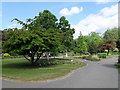
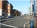
Living in PO1 3YF means residing within a specific postcode cluster in Portsmouth, England. This residential area houses a population of 1,291 people, creating an intimate community feel typical of smaller postal districts. The area functions as a compact node within the broader Portsmouth urban fabric, offering residents a defined sense of place. Daily life here centres on proximity to major transport hubs rather than isolation within a quiet countryside setting. You are situated close to coasts and waterfronts, given the area's naming convention and location within the PO1 postcode sector. The environment is shaped by its density and the specific needs of its 1,291 residents who rely on central services for their lifestyle. This cluster does not offer the sprawling green spaces found in larger boroughs but compensates with immediate access to transport links. A buyer looking at this address is entering a market defined by its concentration in a harbour-side city. The distinct character of PO1 3YF arises from its integration into the high-density living patterns of Portsmouth.
- Area Type
- Postcode
- Area Size
- Not available
- Population
- 1291
- Population Density
- 7877 people/km²
The property market in PO1 3YF is defined almost entirely by flats, as this is the predominant accommodation type within the postcode. With only 19% of residents owning their homes, the area represents a significant rental market rather than an owner-occupied community. Buyers viewing homes in PO1 3YF will find a stock tailored to multi-unit living rather than detached houses or semi-detached properties. This concentration of flats shapes the physical environment, creating high-density clusters that maximise housing supply in a compact footprint. If you are looking to purchase, you must be prepared to navigate a landscape where commercial ownership dominates private tenure. The low ownership statistic implies that investment landlords and housing associations hold a major share of the buildings. This structure offers convenience for those who want to live centrally without managing maintenance, as many flat managers handle building upkeep. However, the rental nature means fewer standard sale-remaining procedures apply. Every tenant here pays rent rather than a mortgage. The property landscape is a clear indicator of Portsmouth's focus on density and urban efficiency.
House Prices in PO1 3YF
No properties found in this postcode.
Energy Efficiency in PO1 3YF
Your daily lifestyle in PO1 3YF is defined by immediate access to essential retail and transport amenities. There are five notable retail locations available, including the Co-op Queen, The Southern Co-operative Co, and the large Tesco Portsmouth. These shops provide everything from groceries to household goods without the need for a lengthy journey. Beyond shopping, you have direct access to five railway stations and three ferry terminals that serve as vital lifelines to the rest of the UK. The Southsea Hoverport and Portsmouth Harbour Station Pier allow you to depart for the Isle of Wight or other coastal destinations. Cultural events and entertainment are often held at these waterfront venues, adding variety to your weekends. The proximity to these facilities means your evening plans rarely involve long travel times. You can grab dinner at a nearby cafe before catching a ferry or a train, blending work and leisure efficiently. The area's layout prioritises functionality, ensuring that essential services are always within a short walking distance. Living here gives you the convenience of city living with the option for easy regional escapes.
Amenities
Schools
| Rank | School | Type | Entry gender | Ages |
|---|
Explore more schools in this area
Go to Schools tabDemographics
The community in PO1 3YF reflects a mature demographic profile with a median age of 47 years. The most common age range consists of adults between 30 and 64 years, indicating a neighbourhood dominated by working-age families and established professionals. Home ownership stands at just 19%, meaning the vast majority of the population rents their homes. This low ownership rate contrasts sharply with suburban areas where outright purchase is more common. Instead, you will find a rental market that cater sores to those seeking flexibility or apartments rather than traditional family houses. The predominant ethnic group is White, which aligns with the broader demographic makeup of Portsmouth. Residents here have adapted their lives around the constraints and benefits of this rental-heavy arrangement. The absence of a strong property-owning majority suggests a transient or commuter population who prioritise location over building long-term equity in the property itself. You are joining a society where tenancy norms are the standard operating procedure for the 81% of households that do not own their properties.
Household Size
Accommodation Type
Tenure
Ethnic Group
Religion
Household Composition
Age
Household Deprivation
NS-SEC
Explore more demographic insights in this area
Go to Demographics tabPlanning
Planning Constraints
- Flood RiskPremium
- Ramsar Wetland SitesPremium
- Area of Outstanding Natural BeautyPremium
- Protected Nature ReservePremium
- Protected WoodlandPremium