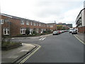
Area Overview for PO1 2RG
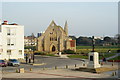
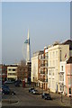
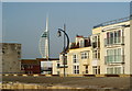
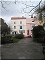
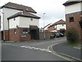
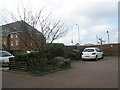
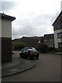
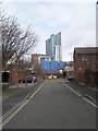
Photos of PO1 2RG


Area Information
Living in PO1 2RG means choosing a compact residential cluster defined by its high density and proximity to key transport links. This specific postcode covers a small residential area of just 6,268 square metres, holding a population of 1,839 people. The sheer concentration of residents within such a limited footprint creates a distinct urban village feel. You will find yourself surrounded by immediate neighbours, which can foster a tight-knit community atmosphere but also limits the space typically associated with wider suburbs. Daily life here revolves around the immediate vicinity and the wider Portsmouth area, given the location's strategic positioning near major ferry terminals and railway stations. The area functions as a dense hub where residents rely on nearby amenities rather than long drives for daily needs. Because the land area is so small, development options are constrained, making every existing property valuable. Whether you are walking to a local shop or heading to a ferry terminal, distances are short and manageable. Understanding the character of PO1 2RG requires recognising its density; it is not a sprawling housing estate but a concentrated living environment where privacy often depends on building layout rather than distance to neighbours.
- Area Type
- Postcode
- Area Size
- 6268 m²
- Population
- 1839
- Population Density
- 3301 people/km²
House Prices in PO1 2RG
Showing 68 properties
| Address | Type | Beds | Baths | Last Sale Price | Last Sale Date | |
|---|---|---|---|---|---|---|
| 8E, Sun Court, Landport Terrace, Portsmouth, PO1 2RG | Flat | - | - | £160,000 | Dec 2022 | |
| 8C, Sun Court, Landport Terrace, Portsmouth, PO1 2RG | Flat | - | - | £195,000 | Nov 2021 | |
| 8B, Sun Court, Landport Terrace, Portsmouth, PO1 2RG | Flat | - | - | £230,000 | Sep 2020 | |
| 11 Landport Terrace, Portsmouth, PO1 2RG | Terraced | - | - | £500,000 | Apr 2020 | |
| 6D, Sun Court, Landport Terrace, Portsmouth, PO1 2RG | Flat | - | - | £208,000 | Oct 2019 | |
| 6B, Sun Court, Landport Terrace, Portsmouth, PO1 2RG | Flat | 3 | - | £230,000 | Dec 2016 | |
| 6C, Sun Court, Landport Terrace, Portsmouth, PO1 2RG | Flat | 3 | 2 | £218,000 | Mar 2016 | |
| 8D, Sun Court, Landport Terrace, Portsmouth, PO1 2RG | Flat | 2 | 1 | £170,000 | Sep 2011 | |
| 26 Landport Terrace, Portsmouth, PO1 2RG | Flat | 7 | 1 | £125,000 | May 2008 | |
| 7A, Sun Court, Landport Terrace, Portsmouth, PO1 2RG | Flat | - | - | £114,000 | Jun 2007 |
Energy Efficiency in PO1 2RG
Amenities
Schools
| Rank | School | Type | Entry gender | Ages |
|---|
Explore more schools in this area
Go to Schools tabDemographics
The community in PO1 2RG is heavily skewed towards young adults, with a median age of just 22 years. The most common age range for residents is 15 to 29 years, indicating an area dominated by students, young professionals, or early-career individuals. Only 41% of residents own their homes, which suggests a high proportion of tenants living in the locality. Flats are the predominant accommodation type, aligning with the high population density and the age profile of the inhabitants. The area is predominantly White according to the demographic data provided. With nearly three in four residents under 30, the social scene likely centres around nightlife, part-time work, and educational pursuits rather than multi-generational family gatherings. Home ownership rates lower than the national average imply a market driven by rental demand and investment properties rather than long-term family settlement. You should expect a demographic environment where young people mix, influencing local culture and consumption patterns. This age profile means that local spaces cater heavily to those in early adulthood, potentially affecting the availability of family-focused services compared to areas with older populations. The high density combined with the young age range creates a dynamic but potentially transient living environment.
Household Size
Accommodation Type
Tenure
Ethnic Group
Religion
Household Composition
Age
Household Deprivation
NS-SEC
Explore more demographic insights in this area
Go to Demographics tabPlanning
Planning Constraints
- Flood RiskPremium
- Ramsar Wetland SitesPremium
- Area of Outstanding Natural BeautyPremium
- Protected Nature ReservePremium
- Protected WoodlandPremium