Area Overview for PO1 2PA
Photos of PO1 2PA
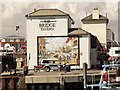
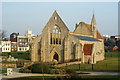
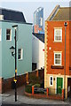
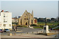
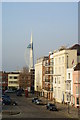
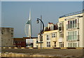
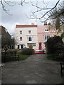
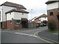
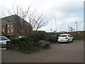
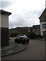
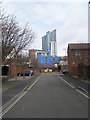
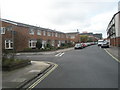
100 photos from this area
Area Information
Key information about the PO1 2PA including its size, population, and administrative classification.
- Area Type
- Postcode
- Area Size
- 2686 m²
- Population
- 1839
- Population Density
- 3301 people/km²
House Prices in PO1 2PA
14
Properties
£307,800
Average Sold Price
£114,000
Lowest Price
£670,000
Highest Price
Showing 14 properties
| Address | Type | Beds | Baths | Last Sale Price | Last Sale Date | |
|---|---|---|---|---|---|---|
| 15 Peacock Lane, Portsmouth, PO1 2PA | house | - | - | £670,000 | Jan 2025 | |
| 6 Peacock Lane, Portsmouth, PO1 2PA | house | 3 | - | £365,000 | Jul 2022 | |
| 13 Peacock Lane, Portsmouth, PO1 2PA | Terraced | 4 | - | £460,000 | Aug 2019 | |
| 5 Peacock Lane, Portsmouth, PO1 2PA | Cottage | 2 | 1 | £300,000 | Dec 2017 | |
| 2B Peacock Lane, Portsmouth, PO1 2PA | house | 4 | 1 | £360,000 | Oct 2014 | |
| 7 Peacock Lane, Portsmouth, PO1 2PA | Terraced | 2 | - | £225,000 | Dec 2013 | |
| The Coach House, Peacock Lane, Portsmouth, PO1 2PA | Terraced | 4 | 2 | £200,000 | Mar 2009 | |
| 2 Peacock Lane, Portsmouth, PO1 2PA | Terraced | 3 | 1 | £270,000 | Nov 2007 | |
| 9 Peacock Lane, Portsmouth, PO1 2PA | Terraced | - | - | £114,000 | Mar 1998 | |
| 13A Peacock Lane, Portsmouth, PO1 2PA | Terraced | - | - | £114,000 | Oct 1997 |
Page 1 of 2
Energy Efficiency in PO1 2PA
Amenities
Schools
| Rank | School | Type | Entry gender | Ages |
|---|
Explore more schools in this area
Go to Schools tabDemographics
Household Size
Two person
most common
Accommodation Type
Flats
most common
Tenure
41
majority
Ethnic Group
White
most common
Religion
N/A
most common
Household Composition
N/A
most common
Age
22
median
Young Adults (15-29 years)
most common
Household Deprivation
N/A
with no deprivation
NS-SEC
33
in Lower managerial occupations
Explore more demographic insights in this area
Go to Demographics tabPlanning
Planning Constraints
- Flood RiskPremium
- Ramsar Wetland SitesPremium
- Area of Outstanding Natural BeautyPremium
- Protected Nature ReservePremium
- Protected WoodlandPremium