Area Overview for PO1 2NL
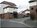
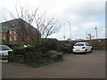
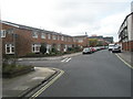
Photos of PO1 2NL


Area Information
Living in PO1 2NL means residing in a compact residential cluster that spans just 1.2 hectares. This small postcode area accommodates a population of 1,839 people, resulting in extremely dense housing conditions with a recorded density of 154,984 people per square kilometre. The geography is defined by its concentration rather than expansive streets or wide-open spaces. You are typically situated within a short walking distance to the vital transport hubs that define Portsmouth Harbour. The location places you immediately adjacent to key ferry terminals, including the Portsmouth IOW Car Ferry Terminal and the Portsmouth Millenium Pontoon. Daily life revolves around proximity to the water and the ease of crossing to the Isle of Wight. Your immediate neighbours are likely to be other residents within this tight-knit group, given the high population density. The area offers practical access to major rail stations like Portsmouth & Southsea Railway Station and Portsmouth Harbour Railway Station without requiring a vehicle. You benefit from a location that integrates directly with the broader harbour district, ensuring that your daily commute or leisure trip to the coast is a matter of minutes.
- Area Type
- Postcode
- Area Size
- 1.2 hectares
- Population
- 1839
- Population Density
- 3301 people/km²
Homes in PO1 2NL are defined by a distinct lack of traditional family settings due to the prevalence of flats. The accommodation type data confirms that flats are the dominant form of housing stock in this postcode. With home ownership standing at 41%, the market operates heavily on a rental basis. This 59% rental share suggests that prospective buyers should expect a highly active letting sector alongside private sales. The high population density of 154,984 people per square kilometre drives demand for compact, efficient living spaces rather than detached or semi-detached houses. You will find that the housing options are concentrated to accommodate the local population of 1,839 within a mere 1.2 hectares. This scarcity of space limits housing stock diversity, focusing supply on vertical living arrangements. For those seeking to purchase, the low ownership rate indicates that competitor buyers are likely investors or first-time movers looking for affordable entry points. The market dynamics here are driven by the need for dense, efficient units suited to the young adult demographic that characterises the area.
House Prices in PO1 2NL
Showing 32 properties
| Address | Type | Beds | Baths | Last Sale Price | Last Sale Date | |
|---|---|---|---|---|---|---|
| Old Harbour Mews, 94 Penny Street, Portsmouth, PO1 2NL | Flat | 2 | 2 | £375,000 | Feb 2025 | |
| Old Harbour Mews, 76 Penny Street, Portsmouth, PO1 2NL | Flat | - | - | £410,000 | Mar 2023 | |
| Old Harbour Mews, 86 Penny Street, Portsmouth, PO1 2NL | Flat | - | - | £465,000 | Nov 2022 | |
| Old Harbour Mews, 72 Penny Street, Portsmouth, PO1 2NL | Flat | - | - | £382,500 | Dec 2021 | |
| Old Harbour Mews, 98 Penny Street, Portsmouth, PO1 2NL | Flat | - | - | £550,000 | Dec 2019 | |
| Old Harbour Mews, 80 Penny Street, Portsmouth, PO1 2NL | Flat | - | - | £352,500 | Oct 2019 | |
| Old Harbour Mews, 82 Penny Street, Portsmouth, PO1 2NL | Flat | - | - | £342,000 | Sep 2019 | |
| 56 Penny Street, Portsmouth, PO1 2NL | Terraced | 3 | 2 | £1,500 | Feb 2019 | |
| 106 Penny Street, Portsmouth, PO1 2NL | Semi-detached | 4 | 2 | £520,000 | Nov 2018 | |
| 54B Penny Street, Portsmouth, PO1 2NL | house | 3 | 2 | £805,000 | Oct 2017 |
Energy Efficiency in PO1 2NL
Life in PO1 2NL is convenience-driven, with essential amenities located within immediate reach. Your daily shopping needs are met by five retail outlets in the vicinity, notably including Tesco Old and Tesco Portsmouth. Both national hypermarkets offer a one-stop solution for groceries and household goods. You also have access to five rail stations nearby, which function as both transport hubs and social gathering points; Portsmouth Harbour Railway Station and Southsea Hoverport are key examples of these transport links. Entertainment and transport integration are highlighted by the presence of the Portsmouth & Southsea Railway Station and Smallbrook Junction, associated with the Isle of Wight Steam Railway. Ferry access is equally integral, with five major ferry terminals operating close by, including the Portsmouth Millenium Pontoon. This concentration of amenities ensures that you rarely need to travel far for basics. The proximity to these large-scale transport and retail sites defines the shopping and leisure character of your daily routine.
Amenities
Schools
Families looking at schools near PO1 2NL have access to institutions with varying characteristics. St Jude's CofE Primary School lies nearby and holds a 'good' Ofsted rating, offering a state school education. The area also provides proximity to The Portsmouth Grammar School, which operates as an independent institution. This mix means residents have the option to choose between a maintained state school with a positive rating and a private academy that often caters to families seeking different educational philosophies or religious schooling. The presence of both types within close reach offers flexibility for parents moving to PO1 2NL. St Jude's serves the younger demographic effectively, aligning with the school entry ages found in this 15 to 29 year-old heavy area. The independent option complements the state sector, ensuring that无论 your preferences lie between a Church of England curriculum or a private boarding or day school model, local options exist.
| Rank | School | Type | Entry gender | Ages |
|---|
Explore more schools in this area
Go to Schools tabDemographics
The community within PO1 2NL is strongly characterised by young adults, with the most common age range being 15 to 29 years. The median age for residents is just 22, which significantly shapes the social fabric of this postcode. Home ownership stands at 41%, indicating that the majority of households are likely rented properties or shared accommodations. This statistic aligns with the predominant accommodation type found here, which consists of flats. The demographic profile suggests a student-heavy population or young professionals taking their first steps in the property market. This high proportion of renters contrasts with the 59% of households that do not own their homes. The demographic landscape is predominantly White, reflecting the broader diversity of the Portsmouth area but leaning towards a specific ethnic majority in this specific cluster. The low median age means you will find a vibrant energy on the streets, with a focus on temporary residency and shared living arrangements rather than long-term family estates. This age profile influences local demand, keeping accommodation types geared towards smaller units and flats suitable for singles or couples.
Household Size
Accommodation Type
Tenure
Ethnic Group
Religion
Household Composition
Age
Household Deprivation
NS-SEC
Explore more demographic insights in this area
Go to Demographics tabPlanning
Planning Constraints
- Flood RiskPremium
- Ramsar Wetland SitesPremium
- Area of Outstanding Natural BeautyPremium
- Protected Nature ReservePremium
- Protected WoodlandPremium