Area Overview for PO1 2AE
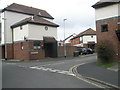
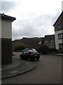
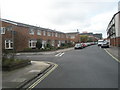
Photos of PO1 2AE


Area Information
Living in PO1 2AE offers a distinct experience within a small residential cluster in England. This specific postcode covers a defined area of 519 square metres, housing a population of 1,339 residents. The density here is incredibly high at 2,580,605 people per square kilometre, which reflects its precise, pinpoint nature as a location coordinate rather than a broad neighbourhood. Daily life centres on close proximity to major hubs such as Portsmouth Harbour Railway Station and the Southsea Hoverport. You will find yourself surrounded by essential services, including the Tesco Old and Portsmouth IOW Car Ferry Terminal, both of which serve as practical anchors for your routine. The area is characterised by its function as a gateway to the Isle of Wight, with the Portsmouth Millenium Pontoon and Portsmouth Harbour Station Pier offering direct sea access. While the physical footprint is minimal, the connectivity is extensive. Residents benefit from immediate access to five railway stations and five ferry terminals. This concentration of transport links means you can access wider Portsmouth opportunities quickly. The environment is free from significant planning constraints, with no designated Ramsar wetland sites, Areas of Outstanding Natural Beauty, or protected nature reserves within the immediate boundaries. For those seeking a location defined by high connectivity and specific logistical advantages, PO1 2AE delivers these features without geographical restrictions.
- Area Type
- Postcode
- Area Size
- 519 m²
- Population
- 1339
- Population Density
- 8353 people/km²
The property market in PO1 2AE is defined by a significant shift toward owner-occupation. With 60% of residents owning their homes, the area leans heavily toward long-term investment rather than a transient rental landscape. This statistic indicates that the majority of prospective buyers will be looking to purchase rather than rent. The accommodation type is exclusively Houses, meaning you will not find flats or apartments in this specific cluster. This aligns with the older demographic, where families and older adults prefer single-family dwellings over shared living spaces. When you look at homes in PO1 2AE, the stock consists of traditional housing stock suited for established families or those seeking a semi-rural feel. The 40% rental proportion remaining suggests a smaller but present market for those who prefer flexibility. However, the dominance of house ownership limits the immediate supply of rental options compared to urban centres. The 1,339 population within such a small area means limited inventory turnover. For a buyer entering this market, competition may be fierce for any available property. The high home ownership rate often results from lower entry prices in surrounding areas, drawing buyers from across Portsmouth. Understanding this dynamic is crucial for anyone calculating their spending power or mortgage requirements. The housing stock reflects a settled community where property values remain relatively stable due to strong owner presence.
House Prices in PO1 2AE
Showing 2 properties
| Address | Type | Beds | Baths | Last Sale Price | Last Sale Date | |
|---|---|---|---|---|---|---|
| 2, The Vaults, Farthing Lane, Portsmouth, PO1 2AE | Maisonette | 3 | - | - | - | |
| 1, The Vaults, Farthing Lane, Portsmouth, PO1 2AE | Flat | - | - | - | - |
Energy Efficiency in PO1 2AE
Daily life in PO1 2AE revolves around immediate access to key amenities and transport hubs. You are surrounded by five retail outlets, with the Tesco Old and Tesco Portsmouth being notable points of interest for shopping. The Southern Co-operative Co-operate provides an additional local option for your weekly needs. Beyond groceries, the area grants easy access to five major ferry terminals, including the Portsmouth Millenium Pontoon and Portsmouth Harbour Station Pier. These locations serve as practical bridges to the Isle of Wight and Chanceaux. Rail transport is equally accessible, with five stations nearby, notably the Portsmouth & Southsea Railway Station and Portsmouth Harbour Railway Station. The Smallbrook Junction, associated with the Isle of Wight Steam Railway, offers a unique leisure option close to your postcode. Living in PO1 2AE provides a lifestyle that balances urban convenience with tourism-oriented facilities. You do not need to travel far to find dining, shopping, or cultural activities. The proximity to the harbour and ferry points suggests a community that values travel and exploration. Your daily errands can be completed within minutes of leaving your house. For residents who enjoy coastal living, the abundance of piers and terminals places you at the heart of maritime activity. The mix of retail and transport creates a vibrant, functional environment without the chaos of a major city centre.
Amenities
Schools
| Rank | School | Type | Entry gender | Ages |
|---|
Explore more schools in this area
Go to Schools tabDemographics
The community in PO1 2AE is dominated by adults between the ages of 30 and 64 years. The median age for residents is 47, indicating a mature demographic profile compared to national averages. A significant proportion of the population owns their homes, with a home ownership rate standing at 60%. This figure suggests a settled community where long-term residents predominate over transient tenancies. The area consists entirely of Houses, aligning with the preference of households in this age group for single-family accommodation. Ethnic diversity is limited here, with White residents forming the predominant ethnic group. The age structure implies that families and empty nesters are the primary occupants of these properties. A median age of 47 often correlates with stable households that may value stability over rapid property turnover. The 60% ownership rate further reinforces the idea that you are looking at a district where people have invested in their local homes. This demographic makeup creates a quiet, established atmosphere rather than a vibrant, shifting student or young professional scene. When considering schools near PO1 2AE, the resident profile suggests a need for institutions catering to children of school age or earlier years, given the concentration of parents in the 30-64 bracket.
Household Size
Accommodation Type
Tenure
Ethnic Group
Religion
Household Composition
Age
Household Deprivation
NS-SEC
Explore more demographic insights in this area
Go to Demographics tabPlanning
Planning Constraints
- Flood RiskPremium
- Ramsar Wetland SitesPremium
- Area of Outstanding Natural BeautyPremium
- Protected Nature ReservePremium
- Protected WoodlandPremium