Area Overview for PO1 1PD
Photos of PO1 1PD

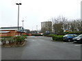
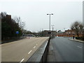
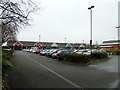
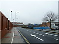
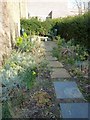
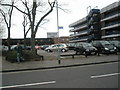
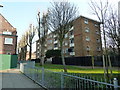
100 photos from this area
Area Information
Key information about the PO1 1PD including its size, population, and administrative classification.
- Area Type
- Postcode
- Area Size
- 1.8 hectares
- Population
- 1959
- Population Density
- 9528 people/km²
House Prices in PO1 1PD
65
Properties
£146,000
Average Sold Price
£12,500
Lowest Price
£405,000
Highest Price
Showing 65 properties
| Address | Type | Beds | Baths | Last Sale Price | Last Sale Date | |
|---|---|---|---|---|---|---|
| 72 Garnier Street, Portsmouth, PO1 1PD | Terraced | 2 | 1 | £195,000 | Feb 2025 | |
| 41 Garnier Street, Portsmouth, PO1 1PD | Terraced | 2 | 1 | £210,000 | Dec 2024 | |
| 48 Garnier Street, Portsmouth, PO1 1PD | Terraced | 2 | 1 | £198,000 | Nov 2024 | |
| 14 Garnier Street, Portsmouth, PO1 1PD | Terraced | 3 | 2 | £405,000 | Dec 2023 | |
| 5 Garnier Street, Portsmouth, PO1 1PD | Terraced | 3 | 1 | £235,000 | Jul 2023 | |
| 16 Garnier Street, Portsmouth, PO1 1PD | house | - | - | £140,000 | Jun 2022 | |
| 1 Garnier Street, Portsmouth, PO1 1PD | Terraced | 4 | 2 | £290,000 | Jan 2022 | |
| 56 Garnier Street, Portsmouth, PO1 1PD | Terraced | 2 | 1 | £225,000 | Sep 2021 | |
| 40 Garnier Street, Portsmouth, PO1 1PD | house | - | - | £200,000 | Jul 2021 | |
| 23 Garnier Street, Portsmouth, PO1 1PD | Terraced | 3 | 1 | £177,000 | Jul 2020 |
Page 1 of 7
Energy Efficiency in PO1 1PD
Amenities
Schools
| Rank | School | Type | Entry gender | Ages |
|---|
Explore more schools in this area
Go to Schools tabDemographics
Household Size
One person
most common
Accommodation Type
Flats
most common
Tenure
16
majority
Ethnic Group
White
most common
Religion
N/A
most common
Household Composition
N/A
most common
Age
47
median
Adults (30-64 years)
most common
Household Deprivation
N/A
with no deprivation
NS-SEC
13
in Lower managerial occupations
Explore more demographic insights in this area
Go to Demographics tabPlanning
Planning Constraints
- Flood RiskPremium
- Ramsar Wetland SitesPremium
- Area of Outstanding Natural BeautyPremium
- Protected Nature ReservePremium
- Protected WoodlandPremium