Area Overview for PO1 1NB
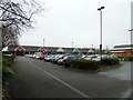
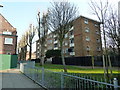
Photos of PO1 1NB


Area Information
PO1 1NB is a defined postcode area encompassing a specific residential cluster covering just 1.1 hectares. Despite its compact size, it supports a population of 4,913 people, creating a densely populated living environment. The area serves as a concentrated hub where daily life revolves around proximity to essential services and transport links. Living in PO1 1NB means accessing a high degree of convenience within a small footprint, making it ideal for those who prioritise urban accessibility without the sprawl of larger towns. The location is situated in England, a position that offers residents a distinct coastal context while maintaining strong integration with the wider Portsmouth infrastructure. This postcode represents a focused slice of residential living where every neighbour is likely nearby, fostering a community dynamic shaped by its tight boundaries. Prospective buyers seeking a specific neighbourhood environment will find PO1 1NB to be a distinct entity separate from the broader surrounding regions. It is a place where the residential fabric is thick, and the scale of the area dictates the pace of life. For individuals researching homes in PO1 1NB, the reality is one of high density and immediate access to key urban functions.
- Area Type
- Postcode
- Area Size
- 1.1 hectares
- Population
- 4913
- Population Density
- 10667 people/km²
The property market in PO1 1NB is defined overwhelmingly by the rental sector, with home ownership recorded at just 9 per cent. This figure indicates that the local housing stock is largely occupied by tenants rather than landlords. The predominant accommodation type consists of flats, a form of property that naturally aligns with a high-volume rental market and located in districts with high population density. Homes in PO1 1NB are not typically freehold family properties but rather flats designed for individual or shared occupancy. This structure suggests a market influenced by student accommodation or shared living arrangements rather than long-term family homeownership. Buyers looking at this specific postcode may find fewer owner-occupied properties available, as the 9 per cent ownership rate is significantly below the national average for such districts. The prevalence of flats reinforces the idea that this is a transient area where housing is used as a leasehold asset. Prospective purchasers should expect a market where rental yields and leasehold management play a larger role than direct residential ownership.
House Prices in PO1 1NB
Showing 10 properties
Energy Efficiency in PO1 1NB
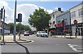
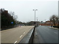
Residents of PO1 1NB enjoy immediate access to a cluster of amenities that define the local lifestyle. Five notable retail outlets are within walking or short driving distance, including Tesco Portsmouth, Iceland Portsmouth, and Sainsburys Portsmouth, ensuring daily shopping needs are easily met. The area is also a transport hub, with five railway stations and five ferry terminals serving the neighbourhood. Portsmouth & Southsea Railway Station and Portsmouth Harbour Railway Station are key nodes for rail travel, while the Portsmouth Harbour Station Pier connects residents to waterborne services. For leisure and commuting, five ferry terminals offer direct links, such as the Portsmouth IOW Car Ferry Terminal and Portsmouth International Cruise & Ferry Terminal. Frequent use of these services is common for the local population. Living in PO1 1NB means your daily routine includes easy trips to the local supermarkets and quick access to major transport interchanges. The density of these five retail and transport entities within reach creates a convenient self-sufficient environment where essentials are never far away.
Amenities
Schools
Families considering schools near PO1 1NB have access to three key institutions listed in the immediate vicinity. St Edmund's Catholic School is a primary school holding an outstanding Ofsted rating, which stands as a clear indicator of high educational standards for younger children. For secondary education, students can attend St Luke's CofE VA Secondary School, which serves the older age groups typical of this region. Additionally, Ark Charter Academy operates as an academy with a good Ofsted rating, providing alternative secondary education options. This mix of outstanding and good ratings offers a robust educational framework for residents with school-aged children. The presence of both primary and secondary institutions means that a family living in this specific postcode could potentially access education for children from early years through to adulthood without commencing travel to distant zones. The variety of school types, including a Catholic primary and an academy, ensures some diversity in the educational ethos available to parents. Choosing schools near PO1 1NB puts families within reach of institutions with proven track records of performance.
| Rank | School | Type | Entry gender | Ages |
|---|
Explore more schools in this area
Go to Schools tabDemographics
The community in PO1 1NB is characterised by a very young demographic profile, with a median age of 22 years. The most common age range comprises young adults between 15 and 29 years old, indicating a population dominated by students and early career professionals. This age distribution shapes the local culture, influencing demand for services and social activities suited to younger residents. Home ownership stands at a low 9 per cent, suggesting that the vast majority of households rent rather than own their properties. This rental-heavy market aligns with the accommodation type, which consists primarily of flats. These dwelling styles suit single occupants and couples without children, reflecting the age skew of the population. While White residents form the predominant ethnic group, the area remains a snapshot of a youthful, transient population. The combination of a young median age and low property ownership rates paints a clear picture of a zone skewed towards temporary living arrangements. Living in PO1 1NB involves a lifestyle typical of a young professional hub, where tenancies are standard and the demographic energy is driven by new arrivals.
Household Size
Accommodation Type
Tenure
Ethnic Group
Religion
Household Composition
Age
Household Deprivation
NS-SEC
Explore more demographic insights in this area
Go to Demographics tabPlanning
Planning Constraints
- Flood RiskPremium
- Ramsar Wetland SitesPremium
- Area of Outstanding Natural BeautyPremium
- Protected Nature ReservePremium
- Protected WoodlandPremium