Area Overview for PO1 1FH
Photos of PO1 1FH


Area Information
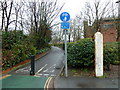
Living in PO1 1FH places you in a specific residential cluster within the Portsmouth postcode district. This postcode covers a small area with a total population of 1,497 residents. You are located in a tightly knit neighbourhood where daily life revolves around proximity and established community routines. The layout is compact, meaning shops, transport links, and schools are all within practical reach without the need for long commutes. Residents here experience a quiet existence defined by the density of the local housing stock rather than expansive green spaces or wide boulevards. The area functions as a self-contained pocket of Portsmouth, offering immediate access to major city facilities while maintaining a distinct residential character. You will find that movement between your home and essential services requires minimal travel time, making it suitable for those who prioritise convenience over distance. The environment supports a settled lifestyle where neighbours know each other, and the ambient noise levels reflect typical urban residential zones near a major port city. This postcode is one stop on the larger map, yet the decisions made here impact thousands of lives across the country. The simplicity of the layout means you can navigate the district easily, whether you are walking to school, driving to a train station, or simply cheering in your front garden.
- Area Type
- Postcode
- Area Size
- Not available
- Population
- 1497
- Population Density
- 9089 people/km²
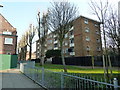
The property market in PO1 1FH is characterised almost entirely by rented accommodation due to the low home ownership rate of just 7%. This statistic reveals a sector where tenants form the backbone of the local housing stock. Flats are the primary accommodation type found throughout the postcode, reflecting a high-density urban structure designed for renters rather than large family homes. You are unlikely to findowner-occupied detached houses in this immediate area, as the architecture prioritises multi-unit living arrangements. Potential buyers looking at PO1 1FH should be prepared for a rental-focused environment where tenancy agreements rather than freehold deeds dominate transactions. The housing stock is built for efficiency and convenience, catering to the needs of the predominantly adult population aged 30 to 64. This profile suggests that the area attracts professionals who prioritise location over ownership status. If you are serious about buying, you must look beyond the immediate bounds of PO1 1FH to find traditional family homes. Within these limits, the focus remains on viable leases and managed residential complexes. The market operates on supply and demand pressures typical of dense urban centres where space is scarce.
House Prices in PO1 1FH
Showing 64 properties
Energy Efficiency in PO1 1FH
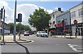
Daily life in PO1 1FH offers immediate access to five major retail outlets including Asda Portsmouth, Tesco Portsmouth, and Farmfoods Fratton. These supermarkets mean you can stock your weekly groceries with a short drive or bus ride. You also have convenient access to five railway stations and five ferry terminals, providing seamless travel options to Portsmouth city centre or the south coast islands. This transport infrastructure supports a lifestyle that blends urban convenience with island escapades. The area caters to practical needs rather than boutique luxury, serving as a functional residential base for those working in nearby employment hubs. Shopping trips become routine tasks rather than long journeys, saving you valuable time during the week. The presence of multiple retail and transport options within a small distance creates a self-sufficient environment where daily errands are quick and efficient. You do not need to venture far for food, clothing, or public transport. This accessibility defines the pace of life, prioritising efficiency and direct routes over exploration of distant attractions.
Amenities
Schools
Families in PO1 1FH have access to several educational institutions clustered nearby, all of which are primary schools attending to the needs of local children. The nearest venues include Arundel Court Junior School and Arundel Court Infant School, which together provide a comprehensive primary education pathway. You will also find Arundel Court Primary School and Nursery and Arundel Court Primary Academy and Nursery operating in the vicinity. These four schools share a common name and are located within a short distance of your postcode. The presence of nurseries alongside junior and infant sections indicates a dedicated specialist facility focused on early childhood development. There are no secondary schools listed in the immediate data for PO1 1FH, meaning older children typically travel to other districts for their education. The concentration of primary institutions suggests the area serves as a catchment zone for younger learners exclusively. If you have young children, the proximity of Arundel Court facilities offers significant convenience for parents managing morning drops and afternoon pickups.
| Rank | School | Type | Entry gender | Ages |
|---|
Explore more schools in this area
Go to Schools tabDemographics
The community in PO1 1FH is defined by a mature demographic profile with a median age of 47 years. The largest group of residents falls into the 30 to 64 age range, indicating a neighbourhood populated largely by working adults and empty nesters. This age distribution suggests stable households rather than a transient population of young families or retirees. Home ownership stands at a very low level, with only 7% of residents owning their properties outright. The vast majority of people here rent their accommodation, reflecting a high demand within a small supply of housing units. Flats constitute the predominant accommodation type, consistent with the density of the postcode and the nature of the local development. The population is ethnically diverse, though White residents form the majority group. You can expect a community where long-term tenants and professional commuters mix, creating a social fabric driven by shared daily routines rather than property equity. The low ownership rate means few families own homes locally, which influences the local rental market dynamics significantly. Residents likely interact primarily through proximity in shared buildings or close neighbourhood watch schemes rather than historical family ties spanning generations.
Household Size
Accommodation Type
Tenure
Ethnic Group
Religion
Household Composition
Age
Household Deprivation
NS-SEC
Explore more demographic insights in this area
Go to Demographics tabPlanning
Planning Constraints
- Flood RiskPremium
- Ramsar Wetland SitesPremium
- Area of Outstanding Natural BeautyPremium
- Protected Nature ReservePremium
- Protected WoodlandPremium