Area Overview for PO1 1EH
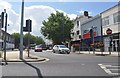
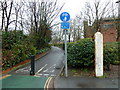
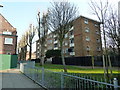
Photos of PO1 1EH


Area Information
Living in PO1 1EH means residing in a very specific residential cluster defined by its postcode rather than a traditional town or village boundary. The area covers just 5452 square metres, indicating a compact neighbourhood within the broader Portsmouth region. You are part of a community of 4913 people packed into this small footprint, resulting in an extremely high population density. Life here is characterised by high urban density and a focus on flat living. This environment suits those who prefer the convenience of city life without the sprawl of larger suburbs. The location sits directly in the heart of the PO1 postcode sector, offering immediate access to港口 facilities and central city services. You will find yourself surrounded by a tight-knit group of residents where daily interactions with neighbours are common due to the limited space. The area lacks significant green belts or industrial zones, focusing entirely on residential accommodation. Your daily routine involves navigating a dense urban setting where everything is within walking distance or a short bus ride away. This postcode serves as a critical living space for students, young professionals, and those seeking proximity to the port and ferry terminals. The compact nature of the area means noise levels can be higher than in suburban developments, reflecting the intensity of city living.
- Area Type
- Postcode
- Area Size
- 5452 m²
- Population
- 4913
- Population Density
- 10667 people/km²
The property market in PO1 1EH is heavily skewed towards rental accommodation due to the low home ownership rate of just 9%. This statistic clearly indicates that the vast majority of homes are let properties rather than owner-occupied houses. Flats are the predominant accommodation type, meaning you will not find traditional detached or semi-detached houses as the primary housing stock. This living style suits those seeking urban convenience but offers less long-term investment security compared to owner-occupied sectors. Buyers looking for a purchase in this specific postcode should expect to find multi-occupancy buildings or large estates purchased by investment firms who then let them out. The high population density leads to a competitive rental market where demand often exceeds supply. If you are considering buying freehold or leasehold, your options will be significantly more limited than in surrounding areas with more varied housing stocks. The market here operates on short-to-medium-term tenancy cycles driven by the student and young professional population. Prices may be lower in absolute terms, but they do not always appreciate as rapidly as in family-oriented suburbs. You would be entering a market where yield for landlords is typically higher, but convenience for owners might be lower due to turnover rates. Understanding this dynamic is crucial if you plan to invest or live in PO1 1EH long term.
House Prices in PO1 1EH
Showing 7 properties
Energy Efficiency in PO1 1EH
Daily life in PO1 1EH is supported by a dense network of amenities reachable within practical walking distance. Residents can access five major railway stations, including Portsmouth & Southsea Railway Station, Fratton Railway Station, and Portsmouth Harbour Railway Station. These stations provide vital links to the rest of Hampshire, London, and across the south coast. Shopping needs are met by Sainsburys Portsmouth, Tesco Portsmouth, and Iceland Portsmouth, ensuring you can grocer shop without travelling far. The area also benefits from world-class ferry connections, with the Portsmouth IOW Car Ferry Terminal, Portsmouth Harbour Station Pier, and Portsmouth International Cruise & Ferry Terminal nearby. These facilities are central to the local economy and daily life, offering travel opportunities to Isle of Wight and European destinations. You will find that essentials are always close, reducing the need for long commutes. The proximity to rail, ferry, and retail hubs creates a lifestyle where work, leisure, and travel all intersect easily. Convenience is the defining feature, allowing you to manage your time efficiently while living in a bustling urban centre.
Amenities
Schools
Families living in PO1 1EH have access to several well-regarded educational institutions nearby. The nearest primary school is St Edmund's Catholic School, which holds an ofsted rating of outstanding. This rating signifies the highest standard of education available at the primary level for children in the vicinity. Families also have easy access to Ark Charter Academy, which is rated good by ofsted. For older children, there is St Luke's CofE VA Secondary School, completing the local educational ecosystem. The mix of an academy and a voluntary aided Catholic school offers parents choices in curriculum styles and community alignment. These schools are situated close enough to be considered the first port of call for those relocating to the area. The presence of an outstanding-rated primary school is a significant positive for families with young children, as retention rates in such schools are often high. You can expect the neighbourhood to support active school run routes despite the high density. The proximity to these institutions reinforces the connection between residential areas and the University of Portsmouth, which often influences the student population in these schools.
| Rank | School | Type | Entry gender | Ages |
|---|
Explore more schools in this area
Go to Schools tabDemographics
The community in PO1 1EH is defined by a distinctly youthful demographic profile. The median age is 22 years old, which confirms that Young Adults between 15 and 29 years are the most common age range here. This skew towards younger residents shapes the social fabric and daily rhythm of the neighbourhood. Home ownership stands at just 9%, proving that this is overwhelmingly a rental market dominated by tenants rather than owners. Flats are the predominant accommodation type, aligning perfectly with the needs of students, temporary workers, and young couples who often rent in such high-density urban zones. While the predominant ethnic group is White, the age profile suggests a diverse student population likely drawn from across the UK for local universities. The low home ownership rate implies that many residents plan to move frequently or require flexibility in their living arrangements. This demographic profile creates a neighbourly atmosphere based on shared academic or career milestones rather than long-term household stability. Families with young children are less common compared to student households or young professionals starting their careers. The area reflects a transient population typical of major university cities where people come to study, work, or train before moving on. You are living among peers who are building their lives rather than settling down permanently in this specific plot of land.
Household Size
Accommodation Type
Tenure
Ethnic Group
Religion
Household Composition
Age
Household Deprivation
NS-SEC
Explore more demographic insights in this area
Go to Demographics tabPlanning
Planning Constraints
- Flood RiskPremium
- Ramsar Wetland SitesPremium
- Area of Outstanding Natural BeautyPremium
- Protected Nature ReservePremium
- Protected WoodlandPremium