Area Overview for PO1 1EB
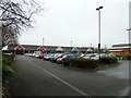
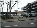
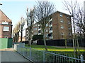
Photos of PO1 1EB


Area Information
Living in PO1 1EB offers a distinct experience within the broader Portsmouth landscape. This specific postcode covers a small residential cluster measuring exactly 3,419 square metres. Despite the limited physical footprint, the area accommodates a population of 1,497 residents, resulting in an exceptionally high population density of 437,864 people per square kilometre. Such density indicates a tightly packed environment where neighbours are inevitably close to one another. Daily life here is defined by proximity to major transport hubs and essential services rather than open space or quiet rural living. The area functions as a concentrated residential zone where convenience takes precedence over seclusion. You will find yourself in a location geared towards ease of access for commuters and families alike. The sheer number of individuals living within these few hectares suggests a high turnover of footfall around local amenities. When you move to PO1 1EB, you are entering a zone where efficiency in transportation and access to facilities is the primary characteristic of the neighbourhood.
- Area Type
- Postcode
- Area Size
- 3419 m²
- Population
- 1497
- Population Density
- 9089 people/km²
The property market in PO1 1EB is defined by its classification as a compact flat-based district. Flats represent the most common type of accommodation available in this specific postcode area. With home ownership standing at only 7 per cent, the market is overwhelmingly dominated by the private rental sector. This ratio suggests that buying a property outright in PO1 1EB is uncommon compared to renting. Prospective buyers looking at homes in PO1 1EB should expect to navigate a market where tenancy agreements are the standard norm. The physical size of the area, which covers just 3,419 square metres, limits the variety of standalone houses you might find in more sprawling postcodes. Instead, the housing stock consists largely of grouped residential units suited to the high-density lifestyle. Whether you are an investor seeking rental yields or someone searching for a home, the nature of the flats dictates the layout and amenities of the living spaces. Understanding this 7 per cent ownership rate helps you gauge the likely age of the stock and the potential for leasehold complications in some cases.
House Prices in PO1 1EB
Showing 24 properties
| Address | Type | Beds | Baths | Last Sale Price | Last Sale Date | |
|---|---|---|---|---|---|---|
| 38 Temple Street, Portsmouth, PO1 1EB | Flat | - | - | £123,500 | Sep 2016 | |
| 22 Temple Street, Portsmouth, PO1 1EB | Flat | - | - | £93,000 | Mar 2013 | |
| 14 Temple Street, Portsmouth, PO1 1EB | Flat | 2 | 1 | £99,999 | Sep 2006 | |
| 32 Temple Street, Portsmouth, PO1 1EB | Flat | - | - | £24,000 | May 1995 | |
| 6 Temple Street, Portsmouth, PO1 1EB | Flat | 2 | - | - | - | |
| 12 Temple Street, Portsmouth, PO1 1EB | Flat | - | - | - | - | |
| 10 Temple Street, Portsmouth, PO1 1EB | Flat | - | - | - | - | |
| 16 Temple Street, Portsmouth, PO1 1EB | Flat | - | - | - | - | |
| 26 Temple Street, Portsmouth, PO1 1EB | Flat | - | - | - | - | |
| 40 Temple Street, Portsmouth, PO1 1EB | Flat | - | - | - | - |
Energy Efficiency in PO1 1EB
The lifestyle in PO1 1EB revolves around convenience and access to major transport and commercial hubs within moments of travel. You can reach five major retail locations, five railway stations, and five ferry terminals without extensive travel time. Notable shopping destinations include Tesco Portsmouth, Iceland Portsmouth, and Sainsburys Portsmouth, providing a full range of groceries and household essentials directly adjacent to your home in PO1 1EB. For commuters, the area offers five nearby rail options starting with Portsmouth & Southsea Railway Station. Frequent travellers will value the presence of the Portsmouth International Cruise & Ferry Terminal and the Portsmouth IOW Car Ferry Terminal, both of which are practically reachable. This density of amenities means you do not need a car for many daily tasks. The area supports a快节奏 lifestyle where work, education, and shopping are tightly integrated. Residents can rely on immediate access to five ferry departure points if they plan trips to the Isle of Wight or mainland Europe.
Amenities
Schools
Parents moving to PO1 1EB have several primary educational options located in immediate proximity to the postcode. The area is well-served by institutions dedicated to early years and primary education. Arundel Court Junior School is available as a primary option, while Arundel Court Infant School caters to younger children. Additionally, Arundel Court Primary School and Nursery provides a combined setting for both primary education and nursery care. Arundel Court Primary Academy and Nursery operates in a similar dual capacity, offering flexibility for families regarding age groups. Having four distinct educational facilities so close to PO1 1EB means you have multiple choices within short walking distance. The presence of both nursery and primary levels under the "Arundel Court" brand name suggests a coordinated approach to early childhood education in this part of Portsmouth. This concentration of schools near your home in PO1 1EB ensures that education planning is straightforward and logistically simple for local residents without needing to rely on catchment areas far away.
| Rank | School | Type | Entry gender | Ages |
|---|
Explore more schools in this area
Go to Schools tabDemographics
The community profile of PO1 1EB reveals a specific demographic reality driven by its high-density accommodation. The median age for residents is 47 years, indicating that the primary demographic consists of adults between 30 and 64 years old. This age range typically comprises established families or couples managing careers rather than young professionals just entering the market. Home ownership sits at a remarkably low level of 7 per cent, which strongly implies that the vast majority of households in this postcode are tenants rather than owners. This rental-heavy structure aligns with the fact that flats are the predominant form of accommodation in PO1 1EB. The population is not diverse in terms of ethnicity, with White residents forming the predominant group. Given the high density and the nature of the housing stock as flats, residents likely interact frequently in shared building corridors and communal areas. The profile suggests a transient yet stable cohort of working-age adults who require accessible housing solutions close to employment and transport links.
Household Size
Accommodation Type
Tenure
Ethnic Group
Religion
Household Composition
Age
Household Deprivation
NS-SEC
Explore more demographic insights in this area
Go to Demographics tabPlanning
Planning Constraints
- Flood RiskPremium
- Ramsar Wetland SitesPremium
- Area of Outstanding Natural BeautyPremium
- Protected Nature ReservePremium
- Protected WoodlandPremium