Area Overview for Peartree Ward
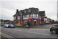
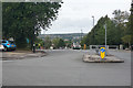
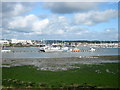
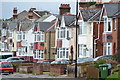
Photos of Peartree Ward


Area Information
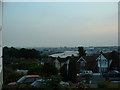
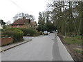
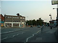
You are looking at a compact district covering just 3.2 square kilometres in Peartree Ward. The population stands at 3,248, creating a setting that remains intimate despite its specific location within the unitary authority structure. This area represents a distinct neighbourhood where daily life unfolds among a relatively small number of residents. The high population density of 1,029 people per square kilometre suggests an area with established_usage patterns and existing infrastructure rather than open, undeveloped land. Living in Peartree Ward involves navigating a space where every square metre supports a significant number of households. This concentration means services are likely within easy reach for most residents, yet the area maintains a defined border separating it from surrounding zones. You will find that the ward functions as a self-contained environment where community interactions occur frequently due to the close proximity of neighbours. The physical boundaries are clear, making it easy to map out the specific streets and amenities that define your daily routine in this part of England. There is no ambiguity about the scale of this community; it is a town-sized pocket of population concentrated into a manageable footprint.
- Area Type
- District Borough Unitary Ward
- Area Size
- 3.2 km²
- Population
- 3248
- Population Density
- 1029 people/km²
Demographics
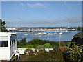
The community in Peartree Ward presents a clear demographic profile centred on older adults. The average age for residents is 70, which establishes a quiet atmosphere focused on retirement rather than movement or industrial activity. This age dominance reflects a stable population where long-term residents have likely deep roots in the locality. You will find that 63% of households own their homes outright or with a mortgage, indicating strong establishment rates among the population. This high ownership figure contrasts with areas dominated by private renting, suggesting a neighbourhood where people stay for decades rather than moving frequently. The data shows no specific breakdown of ethnicity or religion, but the age profile is the defining characteristic of demography here. You are dealing with a cohort that values stability and proximity to local services. The household composition data is generally available, but the specific breakdown of family types versus singles is not detailed in the current records. Unlike bustling university towns or commuter belts, Peartree Ward is defined by its elderly demographic. When you consider who lives in Peartree Ward, you must account for this advanced average age. The community operates at a slower pace, with life centred around healthcare access, leisure activities for seniors, and managing fixed incomes.
Household Size
Accommodation Type
Tenure
Ethnic Group
Religion
Household Composition
Age
Household Deprivation
NS-SEC
Explore more demographic insights in this area
Go to Demographics tabPlanning
Planning Constraints
- Flood RiskPremium
- Ramsar Wetland SitesPremium
- Area of Outstanding Natural BeautyPremium
- Protected Nature ReservePremium
- Protected WoodlandPremium
- Crime RiskPremium