Area Overview for Pamber
Photos of Pamber
Area Information
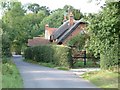
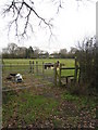
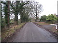
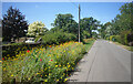
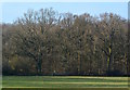
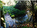
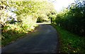
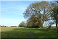
Living in Pamber offers a quiet retreat characterised by low population density and a farmland setting. This civil parish spans 9.4 km², presenting a small footprint where rural life remains the primary backdrop for daily existence. The area provides a peaceful environment away from urban congestion, suitable for those who value seclusion over city amenities. You will find a tightly knit community where neighbours often know each other, reflecting the close-knit nature of many village parishes across England. Daily life centres on local proximity rather than city-centre commutes, meaning your routine revolves around walking distances to essentials rather than travel by train or car. The landscape supports an agrarian lifestyle, which defines the general atmosphere for anyone moving here. Families or individuals seeking isolation and a slower pace will appreciate the open spaces available within this specific parish boundary. Pamber stands as a distinct choice for homebuyers prioritising nature over public transport links. The size of the area means there is little traffic or development pressure, allowing residents to enjoy a stable environment year after year.
- Area Type
- Parish
- Area Size
- 9.4 km²
- Population
- Not available
- Population Density
- Not available
Demographics
The community in Pamber reflects a settled population with strong ties to the locality. In the area, 89% of residents own their homes, indicating a long-term residential character rather than a transient rental market. This high level of ownership suggests many people have lived in Pamber for decades, contributing to a stable social fabric. The average resident is 70 years old, meaning the population skews significantly towards retirees and older generations. You are unlikely to find a youthful demographic, as the age profile shows a clear dominance of older adults within the neighbourhood. Households are composed primarily of individuals or couples where one or both partners are elderly, rather than young families with multiple children. The area lacks significant diversity regarding accommodation types or household structures, as the data points to a uniform living pattern across the parish. Ethnic diversity and religious demographics are not detailed in available records, suggesting a homogenous community profile typical of rural parishes. With 89% ownership and an average age of 70, Pamber is a place where life slows down for those who have the means to stay.
Household Size
Accommodation Type
Tenure
Ethnic Group
Religion
Household Composition
Age
Household Deprivation
NS-SEC
Explore more demographic insights in this area
Go to Demographics tabPlanning
Planning Constraints
- Flood RiskPremium
- Ramsar Wetland SitesPremium
- Area of Outstanding Natural BeautyPremium
- Protected Nature ReservePremium
- Protected WoodlandPremium
- Crime RiskPremium