Area Overview for Combe
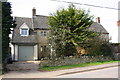
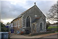
Photos of Combe

Area Information
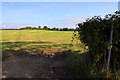
Combe is a compact built-up area in England, spanning 35.2 hectares. Its character is shaped by a population with a median age of 70, suggesting a community rooted in stability and experience. This is not a place of rapid change, but one where familiarity and routine prevail. The area’s size is modest, yet it offers a range of amenities within practical reach, including five railway stations and nearby retail hubs. For those seeking a quieter, low-crime environment, Combe’s safety score of 81/100 indicates a neighbourhood where daily life is largely free from significant risk. Homeownership is strong, with 70% of residents owning their properties, reflecting a community that values long-term investment. Whether you’re drawn to the convenience of nearby shops, the accessibility of rail links, or the presence of a well-rated primary school, Combe offers a blend of practicality and peace. It is not a place for the fast-paced, but for those who prioritise security, simplicity, and proximity to essential services.
- Area Type
- Built Up Area 250
- Area Size
- 35.2 hectares
- Population
- Not available
- Population Density
- Not available
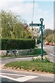
Residents of Combe have access to a range of practical amenities within walking or short driving distance. Retail options include Co-op Long, Co-op Woodstock, and Tesco Eynsham, providing essential shopping and services. The area’s five railway stations, such as Combe and Hanborough, facilitate easy travel to nearby destinations, while two nearby airports offer regional and international connectivity. Though the data does not specify parks or leisure facilities, the presence of multiple retail and transport hubs suggests a focus on convenience and accessibility. For daily life, the combination of shops, rail links, and airports ensures that residents can manage errands, travel, and social needs without significant effort. The area’s compact size and well-connected infrastructure make it practical for those who prioritise efficiency in their routines.
Amenities
Schools
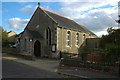
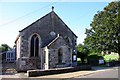
The nearest school to Combe is Combe CofE Primary School, a primary institution with a good Ofsted rating. This school serves the local community and is likely a key factor for families considering the area. The absence of secondary schools in the data means the educational options for older children are not specified, but the presence of a well-rated primary school indicates a focus on early education. For families with young children, the school’s good rating provides reassurance about the quality of teaching and facilities. However, those requiring secondary education may need to look beyond the immediate area for options. The school’s location within practical reach of residents underscores its role as a central amenity, supporting the community’s needs for early learning and development.
| Rank | School | Type | Entry gender | Ages |
|---|
Explore more schools in this area
Go to Schools tabDemographics
Combe’s population is predominantly older, with a median age of 70, and the most common age range encompasses the total population. This suggests a community where retirement and long-term residency are the norm. Homeownership is high, with 70% of residents owning their homes, while 30% are likely to be renters. The data does not specify household types or accommodation categories, but the overall figures indicate a settled population with a focus on stability. There is no explicit information on ethnic diversity or religious composition, but the absence of specific categories means these factors are not highlighted in the available data. The age profile implies a lower demand for childcare or youth-focused amenities, though the presence of a primary school suggests some families do reside here. For those considering Combe, the demographic profile aligns with a community that prioritises comfort, familiarity, and long-term living over dynamic, evolving neighbourhoods.