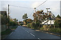
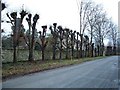
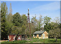
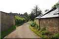
Area Overview for Bampton
Photos of Bampton


Area Information
Living in Bampton means residing within a civil parish that spans 18.3 km² in the heart of England. This specific footprint defines the boundaries of your daily commute and leisure activities. While the area lacks recent population density figures, the existing data points suggest a landscape shaped by its physical size rather than a massive urban crowd. You are purchasing a stake in a location where the environment remains the primary neighbour. The local geography dictates the pace of life, offering a sense of space that larger towns cannot match. For you, the reality of living here involves navigating a defined territory where every acre counts towards your quality of life. Prospective buyers often look for character, and Bampton delivers it through its distinct parish status. The area does not rely on grand statistical claims but rather on tangible features like its covered size and established setting. You will find that the environment supports a quieter existence compared to metropolitan hubs. The 18.3 km² stretch provides enough room for local amenities without the congestion found in bigger cities. This balance is crucial for anyone seeking a homebase that feels connected to the wider world yet insulated from its chaotic edges. Your day-to-day here will be defined by the specific contours of this parish.
- Area Type
- Parish
- Area Size
- 18.3 km²
- Population
- Not available
- Population Density
- Not available
Demographics
The community profile of Bampton tells a clear story about the age and structure of its residents. The median age sits at 70, which establishes Bampton as a village where seniors form a significant portion of the population. You are likely to find a neighbour who has called this place home for decades, contributing to a stable social fabric. This age demographic influences the character of local interactions and the general atmosphere within the parish. The dominance of older residents suggests a slower pace of life compared to younger, growing suburbs. Home ownership stands at an impressive 72%, indicating that the vast majority of people living in Bampton hold the title to their property. This high rate reflects a community that has grown through long-term settlement rather than short-term renting. You will find fewer landlords and more families or individuals invested in the long-term stewardship of their gardens and homes. This stability permeates the neighbourhood, creating an environment where roots run deep. The household composition aligns with this demographic, favouring stability over the fluidity seen in student zones or commuter enclaves. For you, buying a home here means entering a market where residents tend to stay put. The 72% ownership figure is a concrete indicator of this trend. You will not encounter the transient nature of areas with low ownership rates. Instead, you join a group of people who value permanence. This is particularly relevant if you plan to settle for years or decades. The demographic data points clearly, showing a community defined by experience and established presence. Your own tenure will likely mirror that of your neighbours, fostering a shared commitment to the area's upkeep and future.
Household Size
Accommodation Type
Tenure
Ethnic Group
Religion
Household Composition
Age
Household Deprivation
NS-SEC
Explore more demographic insights in this area
Go to Demographics tabPlanning
Planning Constraints
- Flood RiskPremium
- Ramsar Wetland SitesPremium
- Area of Outstanding Natural BeautyPremium
- Protected Nature ReservePremium
- Protected WoodlandPremium