Area Overview for OX9 3AU
Photos of OX9 3AU
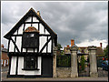


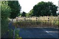

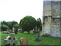


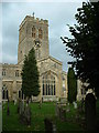


100 photos from this area
Area Information
Key information about the OX9 3AU including its size, population, and administrative classification.
- Area Type
- Postcode
- Area Size
- 3.8 hectares
- Population
- 1325
- Population Density
- 1296 people/km²
House Prices in OX9 3AU
12
Properties
£899,286
Average Sold Price
£225,000
Lowest Price
£1,550,000
Highest Price
Showing 12 properties
| Address | Type | Beds | Baths | Last Sale Price | Last Sale Date | |
|---|---|---|---|---|---|---|
| 31 Aylesbury Road, Thame, OX9 3AU | Detached | 4 | 2 | £800,000 | Dec 2024 | |
| 23 Aylesbury Road, Thame, OX9 3AU | Semi-detached | 3 | 1 | £435,000 | Jun 2021 | |
| 29 Aylesbury Road, Thame, OX9 3AU | house | - | - | £1,450,000 | Jul 2019 | |
| 41 Aylesbury Road, Thame, OX9 3AU | house | - | - | £1,130,000 | Aug 2016 | |
| Lashlake House, Aylesbury Road, Thame, OX9 3AU | Detached | - | - | £1,550,000 | Nov 2015 | |
| 35 Aylesbury Road, Thame, OX9 3AU | house | - | - | £705,000 | Jul 2015 | |
| 45 Aylesbury Road, Thame, OX9 3AU | Semi-detached | - | - | £225,000 | Jul 2004 | |
| 21 Aylesbury Road, Thame, OX9 3AU | house | 4 | 2 | - | - | |
| Jasmine Cottage, Aylesbury Road, Thame, OX9 3AU | house | - | - | - | - | |
| 25 Aylesbury Road, Thame, OX9 3AU | Semi-detached | - | - | - | - |
Page 1 of 2
Energy Efficiency in OX9 3AU
Amenities
Schools
| Rank | School | Type | Entry gender | Ages |
|---|
Explore more schools in this area
Go to Schools tabDemographics
Household Size
Two person
most common
Accommodation Type
Houses
most common
Tenure
77
majority
Ethnic Group
White
most common
Religion
N/A
most common
Household Composition
N/A
most common
Age
47
median
Adults (30-64 years)
most common
Household Deprivation
N/A
with no deprivation
NS-SEC
41
in Lower managerial occupations
Explore more demographic insights in this area
Go to Demographics tabPlanning
Planning Constraints
- Flood RiskPremium
- Ramsar Wetland SitesPremium
- Area of Outstanding Natural BeautyPremium
- Protected Nature ReservePremium
- Protected WoodlandPremium