Area Overview for OX9 2NT
Photos of OX9 2NT


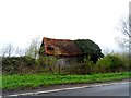


11 photos from this area
Area Information
Key information about the OX9 2NT including its size, population, and administrative classification.
- Area Type
- Postcode
- Area Size
- 15.0 hectares
- Population
- 1598
- Population Density
- 41 people/km²
House Prices in OX9 2NT
22
Properties
£588,750
Average Sold Price
£505,000
Lowest Price
£710,000
Highest Price
Showing 22 properties
| Address | Type | Beds | Baths | Last Sale Price | Last Sale Date | |
|---|---|---|---|---|---|---|
| 21 London Road, Milton Common, Thame, OX9 2NT | Semi-detached | 5 | 2 | £591,250 | Jan 2025 | |
| Great Expectations, London Road, Milton Common, Thame, OX9 2NT | house | - | - | £710,000 | Jul 2023 | |
| 20 London Road, Milton Common, Thame, OX9 2NT | house | - | - | £570,000 | Jan 2023 | |
| 17 London Road, Milton Common, Thame, OX9 2NT | house | - | - | £575,000 | Apr 2021 | |
| 16 London Road, Milton Common, Thame, OX9 2NT | house | - | - | £595,000 | Mar 2021 | |
| 18 London Road, Milton Common, Thame, OX9 2NT | Semi-detached | 5 | 2 | £573,500 | Mar 2021 | |
| 14 London Road, Milton Common, Thame, OX9 2NT | house | - | - | £589,000 | Feb 2021 | |
| 19 London Road, Milton Common, Thame, OX9 2NT | house | - | - | £590,000 | Dec 2020 | |
| 15 London Road, Milton Common, Thame, OX9 2NT | house | - | - | £505,000 | Nov 2020 | |
| 7, Lobb Hill, London Road, Milton Common, Thame, OX9 2NT | Semi-detached | 3 | 2 | - | - |
Page 1 of 3
Energy Efficiency in OX9 2NT
Amenities
Schools
| Rank | School | Type | Entry gender | Ages |
|---|
Explore more schools in this area
Go to Schools tabDemographics
Household Size
Two person
most common
Accommodation Type
Houses
most common
Tenure
76
majority
Ethnic Group
White
most common
Religion
N/A
most common
Household Composition
N/A
most common
Age
47
median
Adults (30-64 years)
most common
Household Deprivation
N/A
with no deprivation
NS-SEC
49
in Lower managerial occupations
Explore more demographic insights in this area
Go to Demographics tabPlanning
Planning Constraints
- Flood RiskPremium
- Ramsar Wetland SitesPremium
- Area of Outstanding Natural BeautyPremium
- Protected Nature ReservePremium
- Protected WoodlandPremium