Area Overview for OX9 2LA
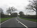
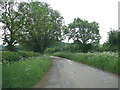
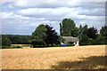
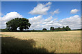
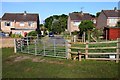
Photos of OX9 2LA


Area Information
OX9 2LA is a compact residential cluster covering 10.7 hectares with a population of 1598 people. The density stands at 41 people per square kilometre, creating a low-density environment that feels spacious despite its postal designation. Living in this small postcode area means experiencing a quiet setting where you are unlikely to encounter overcrowding or urban congestion. The location is situated in England and functions primarily as a sleeping neighbourhood for those working further afield. You can expect a domestic atmosphere defined by houses rather than high-rise blocks or mixed-use commercial developments. The area serves as a practical choice for buyers seeking a specific address without the volume of transactions found in larger towns. Every household here contributes to a community feel that remains relatively intimate. Prospective homebuyers should note that this address represents a specific pocket within the wider countryside belt rather than a standalone village centre. The environment is stable, with no major planning constraints obscuring future development possibilities in the immediate vicinity.
- Area Type
- Postcode
- Area Size
- 10.7 hectares
- Population
- 1598
- Population Density
- 41 people/km²
Homes in OX9 2LA are overwhelmingly occupied by owners given the 76 per cent home ownership rate. The accommodation type data confirms that houses dominate the landscape, with no significant presence of flats or purpose-built rental blocks. This market structure suggests that buying into this postcode means acquiring a substantial property with a degree of permanence. There are very few private landlords operating within these boundaries, which removes one variable for potential sellers looking to downsize. Buyers here are typically looking for a primary residence rather than a holiday home or investment property. The small size of the cluster, measuring just 10.7 hectares, limits inventory availability compared to larger towns like Wheatley nearby. You will find that competition for specific properties may be intense because each house sells individually in a narrow market. The lack of rental stock means that tenants looking for accommodation must search elsewhere, reinforcing the static nature of the housing stock. Conveyancing for these properties will involve standard rural searches rather than complex urban planning permissions.
House Prices in OX9 2LA
No properties found in this postcode.
Energy Efficiency in OX9 2LA
Residents access specific amenities within practical reach of OX9 2LA, shaping the daily rhythm of life in this rural cluster. Waitrose at Wheatley offers a reliable supermarket for grocery shopping, alongside Asda Wheatley and the Co-op Wheatley, which together provide five key retail outlets. These venues allow you to purchase weekly essentials without driving into distant towns for basic necessities. Haddenham & Thame Parkway Railway Station remains the closest rail option, connecting you to broader transport networks for occasional trips. Chalgrove Airport adds a unique feature to the local landscape, though it functions as a private facility rather than a commercial airline hub. There are no listed leisure centres, museums, or major parks directly attached to this postcode, meaning weekend activities will require travel to nearby towns. The lifestyle here revolves around convenience shopping rather than urban entertainment districts. You will find a quiet existence centred on home life with occasional outings to the nearby retail hubs. The absence of heavy traffic or busy shopping streets preserves the peaceful character expected when living in this quiet corner of Oxfordshire.
Amenities
Schools
Families consider the educational options when evaluating living in OX9 2LA. Little Milton Church of England Primary School operates nearby with a Ofsted rating of good, offering a structured curriculum within the local community. The Endowed CofE (Aided) Primary School also serves as an option for younger children, providing another faith-based educational setting within reach. These two institutions comprise the full list of primary schools associated with this area, as no secondary schools or high schools are listed in the available records. You will not find state-funded high schools directly attached to this specific postcode, which means older students likely attend schools in neighbouring towns such as Wheatley or Thame. The availability of two recognised primary options provides sufficient choice for families with children aged four to eleven. Parents commuting from this location must plan travel routes carefully, as direct transport links to secondary education hubs require a journey beyond the immediate neighbourhood boundaries. The existing school mix supports young families who can secure primary education without extensive bus routes or long walking distances.
| Rank | School | Type | Entry gender | Ages |
|---|---|---|---|---|
| 1 | Little Milton Church of England Primary School | primary | N/A | N/A |
| 2 | The Endowed CofE (Aided) Primary School | primary | N/A | N/A |
Explore more schools in this area
Go to Schools tabDemographics
The community profile in OX9 2LA reflects a settled population with a median age of 47 years. Adults between the ages of 30 and 64 form the most common age range, indicating a neighbourhood suited for established households and empty nesters. Home ownership levels are high at 76 per cent, suggesting that the majority of residents own their property outright or via a mortgage rather than renting. Almost all residents live in detached or semi-detached houses, as there is no recorded accommodation data for other housing types. The predominant ethnic group is White, which aligns with the broader rural pattern of similar postcodes in the region. You will find a stable demographic where long-term residents dominate the street rolls. There is a noticeable lack of young families or students compared to city fringe areas, which shapes the social fabric and energy levels throughout the day. This age profile supports local businesses catering to mature tastes and practical requirements. The area maintains consistency in its composition year after year without significant churn in the resident base.
Household Size
Accommodation Type
Tenure
Ethnic Group
Religion
Household Composition
Age
Household Deprivation
NS-SEC
Explore more demographic insights in this area
Go to Demographics tabPlanning
Planning Constraints
- Flood RiskPremium
- Ramsar Wetland SitesPremium
- Area of Outstanding Natural BeautyPremium
- Protected Nature ReservePremium
- Protected WoodlandPremium
- Crime RiskPremium