Area Overview for OX9 2AE
Photos of OX9 2AE
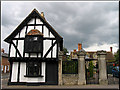


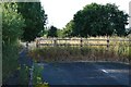

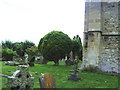
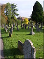


100 photos from this area
Area Information
Key information about the OX9 2AE including its size, population, and administrative classification.
- Area Type
- Postcode
- Area Size
- 1.4 hectares
- Population
- 2767
- Population Density
- 336 people/km²
House Prices in OX9 2AE
14
Properties
£627,333
Average Sold Price
£225,000
Lowest Price
£1,300,000
Highest Price
Showing 14 properties
| Address | Type | Beds | Baths | Last Sale Price | Last Sale Date | |
|---|---|---|---|---|---|---|
| 2 Priest End, Thame, OX9 2AE | Detached | 4 | - | £1,185,000 | Dec 2022 | |
| 14 Priest End, Thame, OX9 2AE | Detached | 4 | 2 | £655,000 | Jan 2021 | |
| 1 Priest End, Thame, OX9 2AE | Semi-detached | 3 | 2 | £560,000 | Jun 2020 | |
| Weslans, Priest End, Thame, OX9 2AE | house | - | - | £965,000 | Dec 2016 | |
| Priest End Farmhouse, 3 Priest End, Thame, OX9 2AE | Detached | 4 | 2 | £1,300,000 | Aug 2016 | |
| 11 Priest End, Thame, OX9 2AE | Bungalow | 2 | - | £410,000 | May 2016 | |
| 9 Priest End, Thame, OX9 2AE | Flat | - | - | £403,000 | Feb 2016 | |
| 10 Priest End, Thame, OX9 2AE | Flat | 2 | - | £225,000 | Feb 2013 | |
| Rycote House, 8 Priest End, Thame, OX9 2AE | Detached | 4 | 2 | £820,000 | Jul 2012 | |
| 12A Priest End, Thame, OX9 2AE | Detached | 4 | 3 | £400,000 | May 2009 |
Page 1 of 2
Energy Efficiency in OX9 2AE
Amenities
Schools
| Rank | School | Type | Entry gender | Ages |
|---|
Explore more schools in this area
Go to Schools tabDemographics
Household Size
Family (3-5 people)
most common
Accommodation Type
Houses
most common
Tenure
79
majority
Ethnic Group
White
most common
Religion
N/A
most common
Household Composition
N/A
most common
Age
47
median
Adults (30-64 years)
most common
Household Deprivation
N/A
with no deprivation
NS-SEC
50
in Lower managerial occupations
Explore more demographic insights in this area
Go to Demographics tabPlanning
Planning Constraints
- Flood RiskPremium
- Ramsar Wetland SitesPremium
- Area of Outstanding Natural BeautyPremium
- Protected Nature ReservePremium
- Protected WoodlandPremium