Area Overview for OX7 6RU
Photos of OX7 6RU
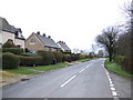


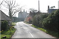
![Idbury House ha ha [1] in OX7 6RU](https://images.propbar.co.uk/images/geograph/19/33/1933070_120.jpg)
33 photos from this area
Area Information
Key information about the OX7 6RU including its size, population, and administrative classification.
- Area Type
- Postcode
- Area Size
- 1.7 km²
- Population
- 2247
- Population Density
- 83 people/km²
House Prices in OX7 6RU
33
Properties
£602,444
Average Sold Price
£60,000
Lowest Price
£1,590,000
Highest Price
Showing 33 properties
| Address | Type | Beds | Baths | Last Sale Price | Last Sale Date | |
|---|---|---|---|---|---|---|
| Church Cottage, Spring Lane, Idbury, OX7 6RU | house | - | - | £650,000 | Sep 2024 | |
| The Thatched Cottage, Spring Lane, Idbury, OX7 6RU | Cottage | 3 | 2 | £1,150,000 | Aug 2024 | |
| The Forge, 30 Church Street, Idbury, OX7 6RU | Detached | 5 | 2 | £1,590,000 | Jan 2020 | |
| The Old School, Church Street, Idbury, OX7 6RU | house | - | - | £1,050,000 | Oct 2017 | |
| Yellands, 1 Spring Lane, Idbury, OX7 6RU | Cottage | 4 | - | £227,000 | Aug 2003 | |
| 4, Manor Barns, Road From A 424 To Idbury, Idbury, OX7 6RU | Semi-detached | 3 | 3 | £320,000 | Feb 2003 | |
| Long Barn, Church Street, Idbury, OX7 6RU | Detached | - | - | £235,000 | Apr 2000 | |
| Paddock Cottage, Spring Lane, Idbury, OX7 6RU | Detached | - | - | £140,000 | Dec 1998 | |
| The Old Barn, Spring Lane, Idbury, OX7 6RU | Detached | - | - | £60,000 | Mar 1997 | |
| 2, The Hayloft, Manor Barns, Road From A 424 To Idbury, Idbury, OX7 6RU | Semi-detached | 4 | 2 | - | - |
Page 1 of 4
Energy Efficiency in OX7 6RU
Amenities
Schools
| Rank | School | Type | Entry gender | Ages |
|---|
Explore more schools in this area
Go to Schools tabDemographics
Household Size
Two person
most common
Accommodation Type
Houses
most common
Tenure
71
majority
Ethnic Group
White
most common
Religion
N/A
most common
Household Composition
N/A
most common
Age
47
median
Adults (30-64 years)
most common
Household Deprivation
N/A
with no deprivation
NS-SEC
42
in Lower managerial occupations
Explore more demographic insights in this area
Go to Demographics tabPlanning
Planning Constraints
- Flood RiskPremium
- Ramsar Wetland SitesPremium
- Area of Outstanding Natural BeautyPremium
- Protected Nature ReservePremium