Area Overview for OX7 6LF
Photos of OX7 6LF
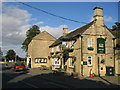


44 photos from this area
Area Information
Key information about the OX7 6LF including its size, population, and administrative classification.
- Area Type
- Postcode
- Area Size
- 4.4 hectares
- Population
- 2247
- Population Density
- 83 people/km²
House Prices in OX7 6LF
14
Properties
£549,100
Average Sold Price
£115,000
Lowest Price
£1,421,000
Highest Price
Showing 14 properties
| Address | Type | Beds | Baths | Last Sale Price | Last Sale Date | |
|---|---|---|---|---|---|---|
| Wyndley, Church Road, Milton Under Wychwood, OX7 6LF | Detached | 3 | 2 | £545,000 | Aug 2023 | |
| HIGH FIELDS, CHURCH ROAD, Milton under Wychwood, OX7 6LF | Land | 4 | - | £1,421,000 | May 2022 | |
| Trinders Cottage, Church Road, Milton Under Wychwood, OX7 6LF | house | - | - | £355,000 | Jan 2022 | |
| FLAT B, ORCHARD BARN, CHURCH ROAD, Milton under Wychwood, OX7 6LF | Flat | - | - | £140,000 | Feb 2020 | |
| Inns Keep, Church Road, Milton Under Wychwood, OX7 6LF | Terraced | 3 | 2 | £510,000 | Sep 2018 | |
| Little Hill Barn, Church Road, Milton Under Wychwood, OX7 6LF | house | - | - | £670,000 | May 2017 | |
| Clayden, Church Road, Milton Under Wychwood, OX7 6LF | Detached | 4 | - | £385,000 | Aug 2010 | |
| Pebblebrook House, Church Road, Milton Under Wychwood, OX7 6LF | Flat | - | - | £695,000 | Nov 2005 | |
| Cottage Farm, Church Road, Milton Under Wychwood, OX7 6LF | house | - | - | £655,000 | Apr 2005 | |
| Longmoor, Church Road, Milton Under Wychwood, OX7 6LF | Detached | - | - | £115,000 | Jun 1997 |
Page 1 of 2
Energy Efficiency in OX7 6LF
Amenities
Schools
| Rank | School | Type | Entry gender | Ages |
|---|
Explore more schools in this area
Go to Schools tabDemographics
Household Size
Two person
most common
Accommodation Type
Houses
most common
Tenure
71
majority
Ethnic Group
White
most common
Religion
N/A
most common
Household Composition
N/A
most common
Age
47
median
Adults (30-64 years)
most common
Household Deprivation
N/A
with no deprivation
NS-SEC
42
in Lower managerial occupations
Explore more demographic insights in this area
Go to Demographics tabPlanning
Planning Constraints
- Flood RiskPremium
- Ramsar Wetland SitesPremium
- Area of Outstanding Natural BeautyPremium
- Protected Nature ReservePremium
- Protected WoodlandPremium