Area Overview for OX7 6HF
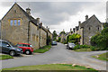
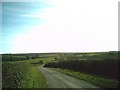
Photos of OX7 6HF
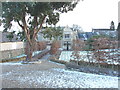

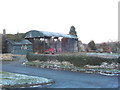
![The Manor, Fifield [1] in OX7 6HF](https://images.propbar.co.uk/images/geograph/23/94/2394450_120.jpg)
![The Manor, Fifield [2] in OX7 6HF](https://images.propbar.co.uk/images/geograph/23/94/2394462_120.jpg)
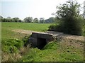
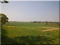
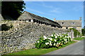
29 photos from this area
Area Information
Key information about the OX7 6HF including its size, population, and administrative classification.
- Area Type
- Postcode
- Area Size
- 5.5 hectares
- Population
- 2247
- Population Density
- 83 people/km²
House Prices in OX7 6HF
11
Properties
£1,282,856
Average Sold Price
£250,000
Lowest Price
£5,100,000
Highest Price
Showing 11 properties
| Address | Type | Beds | Baths | Last Sale Price | Last Sale Date | |
|---|---|---|---|---|---|---|
| The Old Rectory, Church Street, Fifield, OX7 6HF | house | - | - | £5,100,000 | Sep 2021 | |
| 2 Church Street, Fifield, OX7 6HF | house | 2 | - | £355,000 | Jul 2017 | |
| Manor Barn, Church Street, Fifield, OX7 6HF | house | - | - | £2,075,000 | Jun 2017 | |
| Garden Cottage, Church Street, Fifield, OX7 6HF | Detached | - | - | £300,000 | Jul 2007 | |
| Mullions, Church Street, Fifield, OX7 6HF | Semi-detached | 2 | 2 | £400,000 | May 2007 | |
| The Old Post Office, Church Street, Fifield, OX7 6HF | Detached | - | - | £499,995 | May 2003 | |
| 1 Church Street, Fifield, OX7 6HF | house | 2 | - | £250,000 | Jul 2002 | |
| Church Cottage, Church Street, Fifield, OX7 6HF | Detached | 2 | - | - | - | |
| Old Rectory Cottage, Church Street, Fifield, OX7 6HF | house | - | - | - | - | |
| The Stone House, Church Street, Fifield, OX7 6HF | house | - | - | - | - |
Page 1 of 2
Energy Efficiency in OX7 6HF
Amenities
Schools
| Rank | School | Type | Entry gender | Ages |
|---|
Explore more schools in this area
Go to Schools tabDemographics
Household Size
Two person
most common
Accommodation Type
Houses
most common
Tenure
71
majority
Ethnic Group
White
most common
Religion
N/A
most common
Household Composition
N/A
most common
Age
47
median
Adults (30-64 years)
most common
Household Deprivation
N/A
with no deprivation
NS-SEC
42
in Lower managerial occupations
Explore more demographic insights in this area
Go to Demographics tabPlanning
Planning Constraints
- Flood RiskPremium
- Ramsar Wetland SitesPremium
- Area of Outstanding Natural BeautyPremium
- Protected Nature ReservePremium
- Protected WoodlandPremium