Area Overview for OX7 6AN
Photos of OX7 6AN
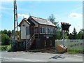

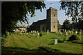
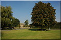


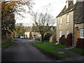
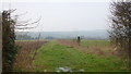


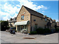

37 photos from this area
Area Information
Key information about the OX7 6AN including its size, population, and administrative classification.
- Area Type
- Postcode
- Area Size
- 50.7 hectares
- Population
- 2175
- Population Density
- 84 people/km²
House Prices in OX7 6AN
22
Properties
£870,000
Average Sold Price
£186,000
Lowest Price
£4,000,000
Highest Price
Showing 22 properties
| Address | Type | Beds | Baths | Last Sale Price | Last Sale Date | |
|---|---|---|---|---|---|---|
| 15 London Lane, Ascott Under Wychwood, OX7 6AN | house | - | - | £899,995 | Sep 2025 | |
| Trevan, 19 London Lane, Ascott Under Wychwood, OX7 6AN | house | 3 | 2 | £670,000 | Jan 2025 | |
| 4 London Lane, Ascott Under Wychwood, OX7 6AN | Retail | 4 | - | £615,000 | Jan 2024 | |
| 6 London Lane, Ascott Under Wychwood, OX7 6AN | house | 3 | - | £870,000 | Jan 2023 | |
| 11 London Lane, Ascott Under Wychwood, OX7 6AN | Detached | 5 | 4 | £460,000 | Mar 2019 | |
| The Old Vicarage, 20 London Lane, Ascott Under Wychwood, OX7 6AN | house | - | - | £4,000,000 | Feb 2019 | |
| 2, Wychwood Court, London Lane, Ascott Under Wychwood, OX7 6AN | house | 4 | - | £634,000 | Mar 2016 | |
| 1, Wychwood Court, London Lane, Ascott Under Wychwood, OX7 6AN | house | 4 | 2 | £600,000 | Apr 2015 | |
| The Old Post Office, 17 London Lane, Ascott Under Wychwood, OX7 6AN | house | 4 | - | £620,000 | Nov 2010 | |
| 3, Wychwood Court, London Lane, Ascott Under Wychwood, OX7 6AN | Retail | 2 | 1 | £440,000 | Nov 2006 |
Page 1 of 3
Energy Efficiency in OX7 6AN
Amenities
Schools
| Rank | School | Type | Entry gender | Ages |
|---|
Explore more schools in this area
Go to Schools tabDemographics
Household Size
Two person
most common
Accommodation Type
Houses
most common
Tenure
77
majority
Ethnic Group
White
most common
Religion
N/A
most common
Household Composition
N/A
most common
Age
47
median
Adults (30-64 years)
most common
Household Deprivation
N/A
with no deprivation
NS-SEC
45
in Lower managerial occupations
Explore more demographic insights in this area
Go to Demographics tabPlanning
Planning Constraints
- Flood RiskPremium
- Ramsar Wetland SitesPremium
- Area of Outstanding Natural BeautyPremium
- Protected Nature ReservePremium
- Protected WoodlandPremium