Area Overview for OX7 5SR
Photos of OX7 5SR
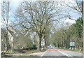


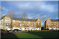


20 photos from this area
Area Information
Key information about the OX7 5SR including its size, population, and administrative classification.
- Area Type
- Postcode
- Area Size
- 4.7 hectares
- Population
- 2280
- Population Density
- 450 people/km²
House Prices in OX7 5SR
18
Properties
-
Average Sold Price
-
Lowest Price
-
Highest Price
Showing 18 properties
| Address | Type | Beds | Baths | Last Sale Price | Last Sale Date | |
|---|---|---|---|---|---|---|
| Confex Ltd, Unit 7, Astley House, Cromwell Park, Chipping Norton, OX7 5SR | retail_financial | - | - | - | - | |
| Unit 5B, Essex House, Cromwell Park, Chipping Norton, OX7 5SR | office_workshop | - | - | - | - | |
| Flight Register Ltd, Unit 1B, Marston House, Cromwell Park, Chipping Norton, OX7 5SR | office_workshop | - | - | - | - | |
| Unit 5A, Essex House, Cromwell Park, Chipping Norton, OX7 5SR | Office | - | - | - | - | |
| Unit 18A, Cheriton House, Cromwell Park, Chipping Norton, OX7 5SR | office_workshop | - | - | - | - | |
| Unit 19A, Cheriton House, Cromwell Park, Chipping Norton, OX7 5SR | Office | - | - | - | - | |
| Unit 11 Ground Floor, Roundway House, Cromwell Park, Chipping Norton, OX7 5SR | retail_financial | - | - | - | - | |
| 11 Asset Holdings Ltd, Unit 24, Stuart House, Cromwell Park, Chipping Norton, OX7 5SR | office_workshop | - | - | - | - | |
| Unit 11 First Floor, Roundway House, Cromwell Park, Chipping Norton, OX7 5SR | retail_financial | - | - | - | - | |
| Shires Wealth Management Limited, Unit 10A, Astley House, Cromwell Park, Chipping Norton, OX7 5SR | retail_financial | - | - | - | - |
Page 1 of 2
Energy Efficiency in OX7 5SR
Amenities
Schools
| Rank | School | Type | Entry gender | Ages |
|---|
Explore more schools in this area
Go to Schools tabDemographics
Household Size
Two person
most common
Accommodation Type
Houses
most common
Tenure
72
majority
Ethnic Group
White
most common
Religion
N/A
most common
Household Composition
N/A
most common
Age
47
median
Adults (30-64 years)
most common
Household Deprivation
N/A
with no deprivation
NS-SEC
41
in Lower managerial occupations
Explore more demographic insights in this area
Go to Demographics tabPlanning
Planning Constraints
- Flood RiskPremium
- Ramsar Wetland SitesPremium
- Area of Outstanding Natural BeautyPremium
- Protected Nature ReservePremium
- Protected WoodlandPremium