Area Overview for OX7 5SL
Photos of OX7 5SL

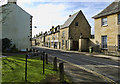
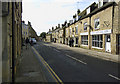

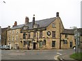
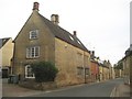
96 photos from this area
Area Information
Key information about the OX7 5SL including its size, population, and administrative classification.
- Area Type
- Postcode
- Area Size
- 5.4 hectares
- Population
- 1867
- Population Density
- 1110 people/km²
House Prices in OX7 5SL
18
Properties
£463,150
Average Sold Price
£329,995
Lowest Price
£605,000
Highest Price
Showing 18 properties
| Address | Type | Beds | Baths | Last Sale Price | Last Sale Date | |
|---|---|---|---|---|---|---|
| 17 Stopford Place, Chipping Norton, OX7 5SL | Detached | 4 | 2 | £605,000 | May 2024 | |
| 2 Stopford Place, Chipping Norton, OX7 5SL | house | - | - | £425,000 | Oct 2022 | |
| 21 Stopford Place, Chipping Norton, OX7 5SL | house | 4 | 2 | £464,995 | Apr 2020 | |
| 23 Stopford Place, Chipping Norton, OX7 5SL | house | - | - | £449,995 | Mar 2020 | |
| 12 Stopford Place, Chipping Norton, OX7 5SL | house | - | - | £524,995 | Mar 2017 | |
| 8 Stopford Place, Chipping Norton, OX7 5SL | house | - | - | £475,000 | Mar 2017 | |
| 19 Stopford Place, Chipping Norton, OX7 5SL | house | - | - | £521,000 | Mar 2017 | |
| 10 Stopford Place, Chipping Norton, OX7 5SL | Detached | 4 | 3 | £559,995 | Feb 2017 | |
| 4 Stopford Place, Chipping Norton, OX7 5SL | house | - | - | £329,995 | Dec 2016 | |
| 6 Stopford Place, Chipping Norton, OX7 5SL | house | - | - | £349,995 | Oct 2016 |
Page 1 of 2
Energy Efficiency in OX7 5SL
Amenities
Schools
| Rank | School | Type | Entry gender | Ages |
|---|
Explore more schools in this area
Go to Schools tabDemographics
Household Size
Family (3-5 people)
most common
Accommodation Type
Houses
most common
Tenure
52
majority
Ethnic Group
White
most common
Religion
N/A
most common
Household Composition
N/A
most common
Age
47
median
Adults (30-64 years)
most common
Household Deprivation
N/A
with no deprivation
NS-SEC
25
in Lower managerial occupations
Explore more demographic insights in this area
Go to Demographics tabPlanning
Planning Constraints
- Flood RiskPremium
- Ramsar Wetland SitesPremium
- Area of Outstanding Natural BeautyPremium
- Protected Nature ReservePremium
- Protected WoodlandPremium