Area Overview for OX7 4JP
Photos of OX7 4JP

Area Information
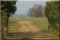
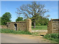
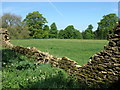
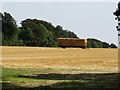
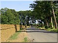
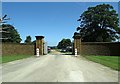
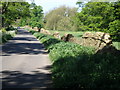
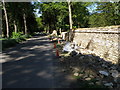
Living in OX7 4JP offers a distinctly rural experience within the Cotswolds, characterised by a very spread-out residential cluster. This specific postcode covers 75.4 hectares of land, home to just 1,623 people. That results in a population density of only 29 people per square kilometre, creating an environment where private space and quiet are the norm rather than the exception. The area feels exclusive not because of high prices or gated roads, but simply because of how much land each resident effectively occupies. You will find that daily life here moves at a slower pace compared to nearby town centres. The vastness of the area means that amenities are not immediately at your doorstep, requiring a vehicle for most errands beyond the nearest village shops. Yet, the low density provides a measurable sense of seclusion that is rare for modern buyers. It is a place where neighbours might only see each other during brief driveway encounters rather than in a shared communal garden or busy street. For those seeking a home on the edge of the south Oxfordshire countryside, this postcode delivers a landscape defined by open skies and limited development.
- Area Type
- Postcode
- Area Size
- 75.4 hectares
- Population
- 1623
- Population Density
- 29 people/km²
You will find that the housing market in OX7 4JP is heavily skewed towards owner-occupation. With 69 per cent of residents owning their homes, the turnover of properties is generally lower than in commuter belt housing estates. The accommodation type is almost exclusively houses, with no apartments or flats recorded in the data for this specific cluster. This means you should expect semi-detached or detached family homes rather than high-density urban living. Steady ownership implies that many streets have been built up generation by generation, with older properties maintaining their original architectural style. Buyers coming to OX7 4JP are likely purchasing established family homes rather than new-build developments. This stability often maintains property values but also means that finding specific types of modern renovations can be difficult given the prevalent stock of traditional houses. The market here reflects a preference for living in a house with a good-sized garden rather than an apartment block.
House Prices in OX7 4JP
Showing 2 properties
| Address | Type | Beds | Baths | Last Sale Price | Last Sale Date | |
|---|---|---|---|---|---|---|
| Beggars Lodge, Lane To Beaconsfield Farm, Great Tew, OX7 4JP | house | - | - | £3,370,000 | Aug 2018 | |
| Annexe, Beggars Lodge, Lane To Beaconsfield Farm, Great Tew, OX7 4JP | Flat | - | - | - | - |
Energy Efficiency in OX7 4JP
Your lifestyle in OX7 4JP is defined by proximity to specific village high streets rather than urban shopping centres. Within practical reach, you will find Budgens Hook, Co-op Deddington, and Waitrose Little. These three retailers provide the essential goods and groceries needed for weekly shopping without the need to travel deep into the countryside. The area also benefits from a rail connection at Heyford Railway Station, which facilitates trips to neighbouring towns for entertainment or larger retail experiences. Beyond shopping, the surrounding 75.4 hectares provide ample space for outdoor activities. The lack of planning constraints such as protected nature reserves or woods near the postcode suggests a landscape that is managed for residential use rather than conservation. This allows for a flexible use of the land for gardens and private drives. Your daily life centres on these accessible high streets, where you can handle all routine needs before returning to a quiet home.
Amenities
Schools
Families in OX7 4JP have access to two primary schools within practical reach, both holding a Good rating from Ofsted. Great Tew County Primary School serves as one option for your children, operating under a community school model. Nearby is the Great Rollright Church of England (Aided) Primary School, which offers an alternative for those seeking a faith-based education. Both institutions are rated Good, providing a solid educational foundation without the pressure of high-tier safeguard ratings. The limited list of schools in the immediate vicinity means that most students beyond these two specific institutions will commute to larger towns like Banbury or Goring-on-Thames. If you prioritize local education, these two primary schools are your main choices for children living in this postcode. Their consistent Good ratings ensure that academic standards remain high regardless of which specific campus you select. These schools integrate well with the rural environment, often encouraging outdoor learning in contrast to bustling urban campuses.
| Rank | School | Type | Entry gender | Ages |
|---|
Explore more schools in this area
Go to Schools tabDemographics
The community in OX7 4JP is defined by an established, mature demographic. The median age stands at 47 years, indicating that the area is primarily populated by adults between the ages of 30 and 64. This age profile suggests a population that has stayed in the area or retired to it from working lives in Oxford or London decades ago. With 69 per cent of households owning their homes, the area reflects long-term permanence rather than a transient rental market. Houses dominate the stock, fitting the architectural expectation for this part of Buckinghamshire and Oxfordshire. The predominant ethnic group is White, which aligns with the broader historical settlement patterns of the South East. While the population is small, the stability is evident in the high rate of family retention. There are very few temporary residents compared to the steady number of owners staying in their properties for decades. This composition creates a neighbourhood where local knowledge runs deep, and the character of the village evolves slowly rather than undergoing rapid change.
Household Size
Accommodation Type
Tenure
Ethnic Group
Religion
Household Composition
Age
Household Deprivation
NS-SEC
Explore more demographic insights in this area
Go to Demographics tabPlanning
Planning Constraints
- Flood RiskPremium
- Ramsar Wetland SitesPremium
- Area of Outstanding Natural BeautyPremium
- Protected Nature ReservePremium
- Protected WoodlandPremium