Area Overview for OX7 3QH
Photos of OX7 3QH
Area Information
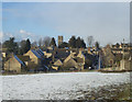
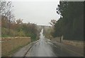
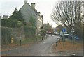
OX7 3QH is a specific postcode area covering a small residential cluster of just 2,023 square metres. This compact footprint has supported a population of 1,176 people, creating a tightly knit settlement. The location sits in England with notably low population density at 130 people per square kilometre compared to national averages. Living in OX7 3QH means navigating a defined boundary where neighbours live in close proximity. The area functions as a distinct residential pocket rather than a sprawling suburb. Its small size defines the daily rhythm for residents who navigate the local streets regularly. You will find that the community scale is manageable, with a clear sense of locality. This cluster offers a contained environment where the relationship between housing stock and land remains visible. Prospective buyers entering OX7 3QH move into a space where boundaries are well understood and the residential character is consistent. The area maintains its identity through this small footprint, ensuring that the environment remains focused purely on housing needs.
- Area Type
- Postcode
- Area Size
- 2023 m²
- Population
- 1176
- Population Density
- 130 people/km²
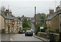
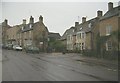
The property market in OX7 3QH is characterised by a strong preference for traditional housing. Houses serve as the primary accommodation type, forming the backbone of the local housing stock. This dominance of houses means that buyers will primarily encounter bungalows, detached properties, or semi-detached homes rather than flats or apartments. The home ownership rate stands at 74%, which is significantly higher than the typical rental-heavy sectors found in major cities. This high percentage indicates that the area is predominantly owner-occupied. Residents have likely invested in these properties with an eye towards long-term residence or inheritance. When viewing homes in OX7 3QH, the market reflects a desire for permanence and stability. This high ownership level suggests that the local estate market values established equity over speculative renting. Prospective buyers should expect a community where most neighbours have been there for a considerable time. The narrow area size of 2,023 square metres reinforces the idea that available housing is scarce and specific. This scarcity often commands higher value from those who secure a plot within the cluster.
House Prices in OX7 3QH
Showing 3 properties
| Address | Type | Beds | Baths | Last Sale Price | Last Sale Date | |
|---|---|---|---|---|---|---|
| 4 Thames Gardens, Charlbury, OX7 3QH | Terraced | 4 | - | £625,000 | Oct 2012 | |
| Talbot Barn, Thames Gardens, Charlbury, OX7 3QH | house | 6 | 2 | - | - | |
| 1 Thames Gardens, Charlbury, OX7 3QH | house | - | - | - | - |
Energy Efficiency in OX7 3QH
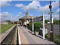
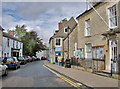
Daily life in OX7 3QH centres on practical access to retail and rail services without the need for extensive travel. There are five notable retail outlets within practical reach, including Co-op Charlbury, Co-op Long, and Budgens Witney. These specific venues provide a range of necessities from groceries to daily essentials. Residents can access fresh food and household goods conveniently near the postcode boundary. Connectivity extends to rail travel with five railway stations identified in the immediate vicinity. Charlbury Railway Station, Finstock Railway Station, and Ascott are among the named stops serving the area. These stations offer practical links for commuting or leisure travel beyond the small residential cluster. The presence of multiple Co-op locations highlights the commercial activity spread across the wider neighbourhood of Witney and surrounding villages. This mix of local shops and town-centre retailers creates a flexible shopping experience. You will find that everyday errands are manageable without driving far. The integration of rail access alongside local high streets ensures that lifestyle needs are met efficiently. This practical setup supports a quiet home life while maintaining necessary connections to the wider region.
Amenities
Schools
| Rank | School | Type | Entry gender | Ages |
|---|
Explore more schools in this area
Go to Schools tabDemographics
The community in OX7 3QH is defined by a stable age profile with a median age of 47 years. Most residents fall into the 30 to 64 years age range, indicating a settled population of adults. Economic stability is evident in the high home ownership level of 74%, suggesting that the majority of households own their properties outright or with a mortgage over the long term. The accommodation type data confirms that houses dominate the residential landscape within this postcode. This preference for houses aligns with the demographic maturity of the residents. The predominant ethnic group is White, reflecting the established character of the neighbourhood. There are no other demographic categories represented in the provided data, meaning the area presents a homogenous community structure. These statistics describe a neighbourhood where families and older residents have established deep roots. The high ownership rate combined with the age distribution points to an area where people stay for decades. This stability creates a predictable social environment for those considering homes in OX7 3QH.
Household Size
Accommodation Type
Tenure
Ethnic Group
Religion
Household Composition
Age
Household Deprivation
NS-SEC
Explore more demographic insights in this area
Go to Demographics tabPlanning
Planning Constraints
- Flood RiskPremium
- Ramsar Wetland SitesPremium
- Area of Outstanding Natural BeautyPremium
- Protected Nature ReservePremium
- Protected WoodlandPremium