Area Overview for OX7 3BP
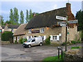
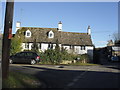
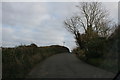
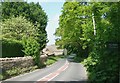
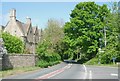
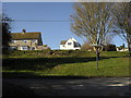
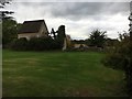
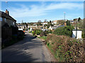
Photos of OX7 3BP


Area Information
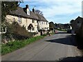
Ox7 3BP represents a specific residential postcode cluster within a demographic profile that defines a quiet English neighbourhood. This small area covers 43.9 hectares and is home to 1,153 residents. The layout suggests a spread-out community where residents benefit from lower density living compared to the national average. With a population density of just 114 people per square kilometre, the space around you feels expansive rather than cramped. You will find that daily life here lacks the immediate bustle of larger urban centres but offers a sense of stability found in established villages. The area is not a sprawling development but a contained cluster of homes where local interactions can develop naturally. Buyers looking for a residential retreat away from high-density housing find this postcode attractive. The specific size of the area means that green space and pedestrian-friendly routes are likely accessible without needing to travel far. This location serves as a distinct pocket of residential calm, ideal for those who prioritise space and a steady, predictable environment over rapid urban growth.
- Area Type
- Postcode
- Area Size
- 43.9 hectares
- Population
- 1153
- Population Density
- 114 people/km²
Homes in Ox7 3BP exist within a property market defined by stability and long-term ownership. With 80 per cent of the area occupied by homeowners, this is distinctly an owner-occupied neighbourhood rather than a rental hub. You will encounter very few buy-to-let properties or short-term lets driving the local economy. The accommodation type is exclusively listed as houses, so you will not find flats or high-rise apartments among the local stock. This housing mix supports a suburban lifestyle where gardens and private outdoor space are common features. Prospective buyers should note that the 80 per cent ownership figure implies strong community ties, as residents are less likely to move frequently. The market here caters to adults seeking permanence and quiet living rather than investors chasing high rental yields. The nature of the homes suggests that price trends will be influenced by local factors rather than speculative development pressure. When searching for properties near this postcode, expect to find a consistent range of family-sized homes suited to established households. The lack of rental stock means that negotiating a purchase often involves dealing with benevolent owners who understand the local sentiment.
House Prices in OX7 3BP
Showing 17 properties
| Address | Type | Beds | Baths | Last Sale Price | Last Sale Date | |
|---|---|---|---|---|---|---|
| 8 Wards Lane, Finstock, OX7 3BP | Bungalow | 3 | - | £735,000 | Oct 2018 | |
| Lavender Cottage, Wards Lane, Finstock, OX7 3BP | Detached | 3 | 2 | £542,500 | Jun 2016 | |
| 1 Wards Lane, Finstock, OX7 3BP | house | 3 | 1 | £350,000 | Nov 2015 | |
| 6 Wards Lane, Finstock, OX7 3BP | house | - | - | £469,000 | Jan 2011 | |
| Carmodale, Wards Lane, Finstock, OX7 3BP | Cottage | 2 | 1 | £247,500 | Dec 2007 | |
| Archangel, 3 Wards Lane, Finstock, OX7 3BP | Terraced | - | - | £274,000 | Apr 2005 | |
| Mill End, Wards Lane, Finstock, OX7 3BP | Chalet | 4 | - | £188,000 | Oct 1999 | |
| 4 Wards Lane, Finstock, OX7 3BP | Cottage | 3 | 2 | £62,553 | May 1999 | |
| Annexe At, 8 Wards Lane, Finstock, OX7 3BP | Detached | 5 | 4 | - | - | |
| 7A Wards Lane, Finstock, OX7 3BP | Flat | - | - | - | - |
Energy Efficiency in OX7 3BP
Your lifestyle in Ox7 3BP is supported by a practical array of amenities within easy reach. Rail travel is accessible through five nearby stations, including Finstock Railway Station, Charlbury Railway Station, and Combe Railway Station. These venues offer connections for those who travel by train for work or leisure. For shopping, you have five retail options close by, featuring Co-op Charlbury, Budgens Witney, and Co-op Long. These supermarkets provide all the daily necessities, grocery shopping, and household essentials without requiring a long journey into a town centre. The presence of multiple Co-operatives ensures competitive pricing and familiar interior layouts. Residents can access food, cleaning supplies, and fresh produce with minimal travel time. The lifestyle here balances convenience with the peace of a residential cluster. You do not need toventure far for essential goods, yet the area remains carside for those who prefer driving. The proximity of these specific retailers creates a practical daily routine that supports a comfortable life without the noise and congestion of busy retail districts.
Amenities
Schools
Education near Ox7 3BP centres on one primary institution, noting that there are no secondary schools listed for this immediate proximity. You will find the Finstock Church of England Primary School within practical reach of the postcode. This school holds an outstanding Ofsted rating, which signals high educational standards and effective teaching methods. Families moving to this area will benefit from a primary option that has already achieved top-tier recognition from inspectors. The presence of a single school indicates that the immediate locality is designed around early childhood education rather than a mixed-feed zone for teenagers. You may need to look beyond the immediate 3BP boundary or into neighbouring villages like Charlbury for secondary or further education options. The outstanding rating makes this school a significant selling point for parents assessing areas for young children. While there are no secondary schools listed in the nearby data, the quality of the primary provision offers a strong start for students. This focus on a single, highly rated primary school shapes the educational profile of the community.
| Rank | School | Type | Entry gender | Ages |
|---|
Explore more schools in this area
Go to Schools tabDemographics
The community within Ox7 3BP reflects a mature market where established residents have put down roots. The median age is 47 years, which is significantly higher than the national average. Most of the population falls into the adult age range between 30 and 64 years old. This skew towards mid-life suggests a stable area rather than one attracting families with young children or students just starting their careers. Home ownership stands at 80 per cent, indicating that the vast majority of houses are owned outright or with a mortgage rather than rented out. This high rate of ownership typically correlates with long-term settlement and lower turnover. The accommodation type consists primarily of houses, meaning detached or semi-detached properties dominate the streets. The predominant ethnic group is White, which aligns with the broader demographic patterns of rural and semi-rural England. You will notice a community character shaped by decades of residency. The high homeownership rate means that neighbours are likely to stay in their homes for many years, creating a cohesive social fabric rather than a transient population.
Household Size
Accommodation Type
Tenure
Ethnic Group
Religion
Household Composition
Age
Household Deprivation
NS-SEC
Explore more demographic insights in this area
Go to Demographics tabPlanning
Planning Constraints
- Flood RiskPremium
- Ramsar Wetland SitesPremium
- Area of Outstanding Natural BeautyPremium
- Protected Nature ReservePremium