Area Overview for OX7 3BH
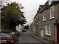
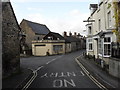
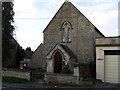
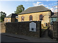
Photos of OX7 3BH
Area Information
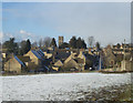
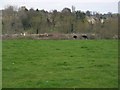
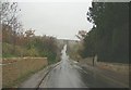
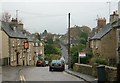
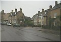
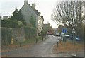
Living in OX7 3BH means settling into a very specific residential cluster in Oxfordshire. This postcode covers a small population of only 1,176 people, creating an intimate neighbourhood where every local street is likely known by name. The area density sits at 130 people per square kilometre, which is moderate for the region. You will find a settled community rather than a rapidly changing high street scene. The housing stock here is almost entirely dedicated to houses, reflecting a preference for traditional family homes over flat living. This character defines the daily rhythm of life in OX7 3BH. Residents enjoy a quiet environment without the chaos of larger urban centres. The scale of the area ensures that neighbours often interact regularly, fostering a strong sense of local loyalty. When you consider homes in OX7 3BH, you are choosing stability and space. The layout supports a slower pace of life compared to the busy outskirts of Oxford. This small cluster offers distinct privacy while remaining close to wider amenities. You can walk down a driveway and find a whole postcode, creating a self-contained feeling within the county. This makes OX7 3BH a compelling choice for those prioritising a quiet, residential setting.
- Area Type
- Postcode
- Area Size
- Not available
- Population
- 1176
- Population Density
- 130 people/km²
The property market in OX7 3BH is defined by private ownership and traditional housing types. With 74% of residents owning their homes, this is fundamentally an owner-occupied area rather than a rental hub. This high ownership percentage signals that buyers here invest for the long term, not just by the season. The accommodation type is predominantly houses, so you will not find the block flats common in city centres. This ensures a quieter, more suburban or rural living standard. When searching for homes in OX7 3BH, your focus should be on detached or semi-detached properties. The small population of 1,176 means the total number of listings is naturally limited compared to larger districts. This scarcity can drive up prices for any property that comes onto the market. You will compete with others who understand the value of this specific locale. The housing stock reflects the needs of the 47-year-old median resident, likely favouring three or four bedrooms. There is no sign of a student rental boom or speculative buying here. The market moves with caution, mirroring the slow pace of life in OX7 3BH. Buyers must act quickly if they find a suitable house, as inventory is low. This dynamic makes owning a home here a significant commitment. The 74% ownership figure suggests strong maintenance standards within the estate, as owners tend to care for their largest asset.
House Prices in OX7 3BH
No properties found in this postcode.
Energy Efficiency in OX7 3BH
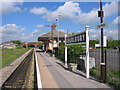
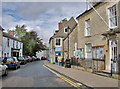
Your daily life in OX7 3BH revolves around practical, locally accessible amenities within a short drive. You have five railway options nearby, including Charlbury Railway Station, Finstock Railway Station, and Ascott. These stations provide essential links to Oxford and London, ensuring you can commute when necessary. For shopping, there are five retail options in your immediate vicinity. Co-op Charlbury serves your weekly groceries and household needs. Budgens Witney offers a larger selection for bigger shopping trips. Co-op Long provides another convenient option for local supplies. These five venues ensure you do not starve for fresh food or essentials. You can run errands in Charlbury on a sunny Sunday afternoon without needing a car. The presence of these specific grocers defines the local lifestyle as self-sufficient yet connected. While dining choices may be limited in the immediate street, the nearby towns offer a range of pubs and cafes. This setup works perfectly for a quieter population median age of 47. You are not living in an isolated village but in a well-connected residential zone. The proximity to five rail stations and five retail outlets means you can plan your week around a train rather than a bus schedule. This convenience is vital for maintaining your routine in a low-density area. Homes in OX7 3BH offer the quiet of the countryside with the practical needs of town living right at your fingertips.
Amenities
Schools
| Rank | School | Type | Entry gender | Ages |
|---|
Explore more schools in this area
Go to Schools tabDemographics
The community in OX7 3BH feels established and mature. The median age here is 47 years, indicating a population leaning towards mid-life adulthood. Most residents fall into the 30 to 64 years age range, suggesting families with grown children or empty nesters are the norm. You will rarely encounter a chaotic youth crowd dominating the high street; instead, the atmosphere feels calm. Home ownership stands at an impressive 74% within this small cluster. This high rate means the majority of people in OX7 3BH own their property outright or via mortgage, rather than renting. Accommodation types are almost exclusively houses, with flats being rare or absent. The predominant ethnic group is White, which aligns with the broader demographic trends of rural Oxfordshire. This demographic mix contributes to a stable, long-term community feel. There is little transience here; people put down roots and stay. The age profile suggests schools near OX7 3BH would cater to teenagers and young adults, while primary and secondary education might be accessed via travel from slightly larger nearby towns. The 74% ownership rate simplifies local politics and social cohesion. When you look at homes in OX7 3BH, you are looking at a settlement built by owners who value permanence. This stability creates a predictable environment for raising a family or enjoying retirement.
Household Size
Accommodation Type
Tenure
Ethnic Group
Religion
Household Composition
Age
Household Deprivation
NS-SEC
Explore more demographic insights in this area
Go to Demographics tabPlanning
Planning Constraints
- Flood RiskPremium
- Ramsar Wetland SitesPremium
- Area of Outstanding Natural BeautyPremium
- Protected Nature ReservePremium
- Protected WoodlandPremium