Area Overview for OX6 9GS
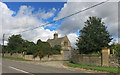
Photos of OX6 9GS


Area Information
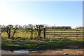
Living in OX6 9GS offers a settled residential experience defined by its intimate scale. This specific postcode covers a small residential cluster with a total population of 2,488. The low density of 73 people per square kilometre ensures a quiet environment without the pressure of high-density urban living. You will find yourself in a distinctly residential zone that prioritises peace and stability over the hustle of a busy town centre. The area provides a familiar neighbourhood atmosphere where you can establish a strong sense of belonging. Daily life centres on local pockets of housing rather than grand landmarks or expansive industrial zones. The small size of the cluster means that distances to nearby essentials are short, making it practical for those who value convenience without needing to drive far. You are living in OX6 9GS, a place where the community is close-knit and the streets are primarily used by residents. The character of the area is shaped by its exclusive residential nature, offering a slice of suburban life that feels insulated from the larger city flows. Prospective buyers will appreciate the straightforward layout and the lack of complex commercial development within the immediate boundaries.
- Area Type
- Postcode
- Area Size
- Not available
- Population
- 2488
- Population Density
- 73 people/km²
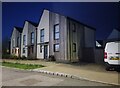
The property market in OX6 9GS reflects a mature, owner-occupied landscape. With 70% of residents owning their homes, the area functions as an established residential zone rather than a transient rental market. Houses are the main accommodation type, meaning the local housing stock consists of standalone dwellings rather than flats or maisonettes. This composition appeals to buyers seeking privacy and green space, though it may not suit those dependent on shared community facilities often found in apartment blocks. The high ownership percentage implies that service prices and local investments tend to benefit long-term residents. You will find homes in OX6 9GS are held by families and individuals who have put down roots. The market is likely slower moving than rental-heavy areas, with transactions focusing on established properties. This texture gives the area a continuity that new developments often lack. Buyers looking for a traditional family home will find the stock matches their requirements, as the density supports spacious layouts.
House Prices in OX6 9GS
No properties found in this postcode.
Energy Efficiency in OX6 9GS
Your daily life in OX6 9GS is supported by a practical selection of local amenities within easy reach. Three supermarkets serve the retail needs of residents, including Tesco Southwold, Co-op Barberry, and Co-op Buckingham Road. These venues ensure you can handle most grocery shopping and daily essentials without needing to travel far for basic goods. For rail travel, three stations are located nearby: Bicester North Railway Station, Bicester Village Railway Station, and Heyford Railway Station. These transport hubs provide a link to the wider town network. The immediate surroundings lack listed parks, leisure centres, or dining venues within the specific amenity data provided. This focus on essential retail and transport means the area functions efficiently for practical daily tasks. If you value a straightforward lifestyle with essential shops and good rail connections, OX6 9GS delivers exactly that. The absence of listed commercial entertainment or parks highlights a purely residential focus, where the character is defined by quiet streets and nearby utilities rather than nightlife or major recreational facilities.
Amenities
Schools
Parents in OX6 9GS have one primary education option immediately nearby. Gagle Brook Primary School is the designated local institution and holds an Ofsted rating of good. This rating signifies that the school meets required standards of quality and care. Currently, the data does not list any secondary schools in the immediate vicinity of the postcode. The mix of schooling relies on this single primary provider for early education within the walkable zone. Families will need to check transport links for secondary education as no secondary schools are listed within the current amenity scope. For those living in OX6 9GS with school-age children, Gagle Brook offers a foundation of education with a verified standard of performance. The reliance on one named institution means parents know exactly where their children will begin their formal schooling. This clarity eliminates uncertainty regarding the initial phase of education for families settling in this cluster.
| Rank | School | Type | Entry gender | Ages |
|---|
Explore more schools in this area
Go to Schools tabDemographics
The community in OX6 9GS is dominated by adults between the ages of 30 and 64 years, reflecting a stable, family-oriented demographic with a median age of 47 years. This age profile suggests residents are likely settled in their careers and households, seeking long-term stability. Home ownership is robust, with 70% of properties held by owners rather than tenants. This high rate indicates a Gemeinde focused on permanence and investment. Houses form the predominant accommodation type, meaning you will find single-family homes and detached dwellings rather than blocks of flats or apartment complexes. The majority of the population identifies as White, which aligns with the broader national trend for this type of residential setting. While specific deprivation statistics are not available in the current profile, the high rate of home ownership and the age of the residents suggest a financially secure community. The environment is tailored to those who prefer a traditional suburban lifestyle rather than a high-rise or student-heavy zone. When considering homes in OX6 9GS, you are entering a market defined by maturity and established ownership.
Household Size
Accommodation Type
Tenure
Ethnic Group
Religion
Household Composition
Age
Household Deprivation
NS-SEC
Explore more demographic insights in this area
Go to Demographics tabPlanning
Planning Constraints
- Flood RiskPremium
- Ramsar Wetland SitesPremium
- Area of Outstanding Natural BeautyPremium
- Protected Nature ReservePremium
- Protected WoodlandPremium